1
Orchard Row houses and bench, Fulbrook, West Oxfordshire
Viewed from the corner of Beech Grove near the A361 junction.
Image: © Jaggery
Taken: 16 Jan 2018
0.01 miles
2
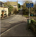
Unsuitable route for heavy goods vehicles, Beech Grove, Fulbrook, West Oxfordshire
The sign faces the A361 junction. The wider road in the foreground becomes
single track ahead, leading to Swinbrook three-quarters of a mile away.
Image: © Jaggery
Taken: 16 Jan 2018
0.04 miles
3
Fulbrook war memorial
Image: © andrew auger
Taken: 8 Apr 2010
0.04 miles
4
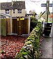
Electricity substation on a Fulbrook corner, West Oxfordshire
In a padlocked wooden enclosure on the corner of Beech Grove and the A361.
Image: © Jaggery
Taken: 16 Jan 2018
0.05 miles
5
Swinbrook direction and distance sign in Fulbrook, West Oxfordshire
Facing the A361, the sign is for Beech Grove https://www.geograph.org.uk/photo/5667679 three-quarters of a mile from Swinbrook.
Image: © Jaggery
Taken: 16 Jan 2018
0.05 miles
6
Benchmark on 'Ellen Cottage'
Ordnance Survey cut mark benchmark described on the Bench Mark Database at http://www.bench-marks.org.uk/bm80000
Image: © Roger Templeman
Taken: 11 Oct 2016
0.05 miles
7
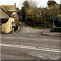
Junction of Beech Grove and the A361, Fulbrook, West Oxfordshire
Viewed across the A361. Beech Grove leads to the single track road to Swinbrook.
The blue sign on the right shows that the road ahead is unsuitable route for heavy goods vehicles.
Image: © Jaggery
Taken: 16 Jan 2018
0.05 miles
8
'Ellen Cottage', Beech Grove
There is an OS benchmark
Image at the junction of the original house and its westwards extension, left of the downpipe near the left hand edge of the image
Image: © Roger Templeman
Taken: 11 Oct 2016
0.05 miles
9
Fulbrook village centre
Looking towards Burford, with the road to Swinbrook on the left.
Image: © David Hawgood
Taken: 1 Mar 2006
0.05 miles
10
Cottage at the western end of Beech Grove, Fulbrook, West Oxfordshire
On the corner of the A361.
Image: © Jaggery
Taken: 16 Jan 2018
0.05 miles


