
IMAGES TAKEN NEAR TO
Rock Close, CARTERTON, OX18 3BP
Introduction
This page details the photographs taken nearby to Rock Close, OX18 3BP by members of the Geograph project.
The Geograph project started in 2005 with the aim of publishing, organising and preserving representative images for every square kilometre of Great Britain, Ireland and the Isle of Man.

There are currently over 7.5m images from over14,400 individuals and you can help contribute to the project by visiting https://www.geograph.org.uk
Image Map
Images are licensed for reuse under creativecommons.org/licenses/by-sa/2.0
Notes
- Clicking on the map will re-center to the selected point.
- The higher the marker number, the further away the image location is from the centre of the postcode.
Image Listing (56 Images Found)
Images are licensed for reuse under creativecommons.org/licenses/by-sa/2.0
Image
Details
Distance
2
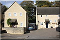
Houses at the north end of Home Close
Image: © Roger Templeman
Taken: 18 Oct 2016
0.07 miles
3
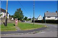
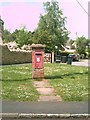
Rock Close, Carterton, Oxon
Rock Close, a residential road, is not really a close as it is a through road connecting Arkell Avenue with Rock Road. The unusual postbox can be seen in close-up here:- Image
Image: © P L Chadwick
Taken: 6 Aug 2016
0.08 miles
4
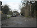
Rough stretch of road
In Carterton, linking Rock Road, and Rock Close. A sign just out of shot gives this as a private road.
Image: © andrew auger
Taken: 13 Dec 2009
0.08 miles
6
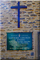
St. Joseph's Catholic Church (4) - information board, Arkell Avenue, Carterton, Oxon
The information board is by the front entrance in Arkell Avenue. For information about the building, formerly a barn, please see:- Image
Image: © P L Chadwick
Taken: 6 Aug 2016
0.10 miles
7
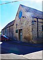
St. Joseph's Catholic Church (3) - front entrance, Arkell Avenue, Carterton, Oxon
For information about the building please see:- Image
Image: © P L Chadwick
Taken: 6 Aug 2016
0.10 miles
8
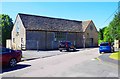
St. Joseph's Catholic Church (1), Arkell Avenue, Carterton, Oxon
The origin of the church building is unusual. It was originally a threshing barn and is probably around two hundred years old. The barley threshed here came from the nearby Rock Farm, and the name Rock survives in two nearby roads. According to the church's website, it is thought that the roof was always stone. In 1940 the building was given to the Catholic community as the congregation had grown due to the development of the RAF aerodrome nearby. Previously a chapel in a private garden had been used. The barn was converted into a church with a large community hall added. In 1973 the former barn became a Grade II listed building.
Image
Image
Image
Image: © P L Chadwick
Taken: 6 Aug 2016
0.10 miles
9
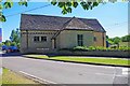
St. Joseph's Catholic Church (2), Arkell Avenue, Carterton, Oxon
For information about the building please see:- Image
Image: © P L Chadwick
Taken: 6 Aug 2016
0.11 miles
10
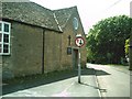
St. Joseph's Roman Catholic Church, Carterton
Image: © andrew auger
Taken: 6 May 2009
0.11 miles