IMAGES TAKEN NEAR TO
Dairy Ground, BANBURY, OX17 3QG
Introduction
This page details the photographs taken nearby to Dairy Ground, OX17 3QG by members of the Geograph project.
The Geograph project started in 2005 with the aim of publishing, organising and preserving representative images for every square kilometre of Great Britain, Ireland and the Isle of Man.

There are currently over 7.5m images from over14,400 individuals and you can help contribute to the project by visiting https://www.geograph.org.uk
Image Map
Images are licensed for reuse under creativecommons.org/licenses/by-sa/2.0
Notes
- Clicking on the map will re-center to the selected point.
- The higher the marker number, the further away the image location is from the centre of the postcode.
Image Listing (16 Images Found)
Images are licensed for reuse under creativecommons.org/licenses/by-sa/2.0
Image
Details
Distance
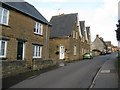
2

Along to the shop
This footpath, not shown on the 1:50K map, runs along the backs of two rows of houses. I stopped to let this lady past. We agreed that although the plants were a lovely colour they were weeds, I told her I was going for a walk (boots on and rucsac on back, not a lie) and she told me she was going along to the shop.
Image: © Graham Horn
Taken: 18 Jun 2009
0.13 miles
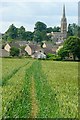
3
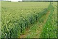
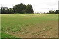
Path north of Kings Sutton
The path through the wheat is clear enough, but not quite in the same location as marked on the map.
Image: © Graham Horn
Taken: 18 Jun 2009
0.15 miles
5
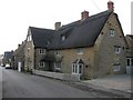
Large House, Richmond Street, King's Sutton
Some lucky person owns this superb large house, with its particularly neat and tidy thatched roof. This shot is looking downhill to the West, down Richmond Street. This peaceful and picturesque village has many treats to offer, if you look for them.
Image: © Kurt C
Taken: 1 Mar 2009
0.18 miles
6
Richmond Street, King's Sutton
A peaceful and picturesque village with many hidden treats if you look for them - that is King's Sutton! Here in Richmond Street, we are looking East uphill and away from Cherwell valley at the bottom of the village.
Image: © Kurt C
Taken: 1 Mar 2009
0.18 miles
7
All roads lead to Rome
Like many rural footpaths, this one leads directly towards the church spire.
Image: © Graham Horn
Taken: 18 Jun 2009
0.19 miles
8
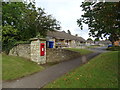
Bungalows, Astrop
Sowing position of Postbox No. OX17 1040.
See Image] for postbox.
Image: © JThomas
Taken: 28 Sep 2019
0.23 miles
9
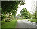
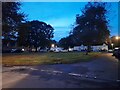
Kings Sutton
Entering Kings Sutton from Upper Astrop
Image: © Snidge
Taken: 22 May 2007
0.23 miles
10
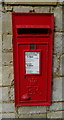
Elizabeth II postbox on Upper Astrop Road
Postbox No. OX17 1040.
See Image] for context.
Image: © JThomas
Taken: 28 Sep 2019
0.23 miles