IMAGES TAKEN NEAR TO
Wimborne Avenue, BANBURY, OX16 0DG

Introduction

This page details the photographs taken nearby to Wimborne Avenue, OX16 0DG by members of the Geograph project.

The Geograph project started in 2005 with the aim of publishing, organising and preserving representative images for every square kilometre of Great Britain, Ireland and the Isle of Man.

There are currently over 7.5m images from over14,400 individuals and you can help contribute to the project by visiting https://www.geograph.org.uk

Image Map


Images are licensed for reuse under creativecommons.org/licenses/by-sa/2.0
Notes
  • Clicking on the map will re-center to the selected point.
  • The higher the marker number, the further away the image location is from the centre of the postcode.

Image Listing (63 Images Found)

Images are licensed for reuse under creativecommons.org/licenses/by-sa/2.0
  • ...
Image
Details
Distance
1
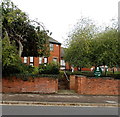
Wimborne Avenue, Banbury
On the east side of Orchard Way.
Image: © Jaggery Taken: 18 Oct 2014
0.03 miles
2
Orchard Way, Banbury
Image: © andrew auger Taken: 5 Jul 2010
0.05 miles
3
Houses at Hilton Road / Wimborne Avenue junction
There is an OS benchmark Image on the near corner of the house by a gate giving access to the side of the house
Image: © Roger Templeman Taken: 16 May 2014
0.06 miles
4
Benchmark on #2 Hilton Road
Ordnance Survey cut mark benchmark described on the Bench Mark Database at http://www.bench-marks.org.uk/bm31203
Image: © Roger Templeman Taken: 16 May 2014
0.06 miles
5
Orchard Way in Banbury
Image: © Steve Daniels Taken: 2 Jul 2021
0.07 miles
6
Junction ahead, Orchard Way, Banbury
Looking along Orchard Way towards its northern end. The right turn ahead for Chipping Norton is also the way to Banbury town centre.
Image: © Jaggery Taken: 18 Oct 2014
0.09 miles
7
Chalkwell high voltage substation, Banbury
Viewed across Warwick Road. The identifier on the Central Networks electricity substation is CHALKWELL H.V. SUBSTATION No 701616.
Image: © Jaggery Taken: 18 Oct 2014
0.10 miles
8
Greenwood Resource Centre, Banbury
Oxfordshire County Council premises on the north side of Warwick Road.
Image: © Jaggery Taken: 18 Oct 2014
0.11 miles
9
Beesley Road, Banbury
Viewed across Orchard Way.
Image: © Jaggery Taken: 18 Oct 2014
0.12 miles
10
Learner motorcyclists in Banbury
Turning from Orchard Way into Warwick Road are two learners, clad in orange dayglo, followed by their black-clad instructor.
Image: © Jaggery Taken: 18 Oct 2014
0.12 miles
  • ...