IMAGES TAKEN NEAR TO
Main Street/The Leys, Main Street, BANBURY, OX15 6QL
Introduction
This page details the photographs taken nearby to Main Street/The Leys, Main Street, OX15 6QL by members of the Geograph project.
The Geograph project started in 2005 with the aim of publishing, organising and preserving representative images for every square kilometre of Great Britain, Ireland and the Isle of Man.

There are currently over 7.5m images from over14,400 individuals and you can help contribute to the project by visiting https://www.geograph.org.uk
Image Map
Images are licensed for reuse under creativecommons.org/licenses/by-sa/2.0
Notes
- Clicking on the map will re-center to the selected point.
- The higher the marker number, the further away the image location is from the centre of the postcode.
Image Listing (24 Images Found)
Images are licensed for reuse under creativecommons.org/licenses/by-sa/2.0
Image
Details
Distance
3

The Stratford Rd in Wroxton
This is the A 422 in Wroxton, the main road through the village as viewed from Leys Close a small residential cul de sac off the main street.
Image: © Nigel Mykura
Taken: 11 Mar 2018
0.10 miles
4
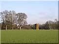
Wroxton Abbey Dovecot and Church Tower
The dovecot and church tower were both designed by Sanderson Miller
Image: © Elizabeth Young
Taken: 12 Dec 2008
0.10 miles
5
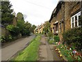
Main Street, Wroxton
The pretty Main Street, with houses built from the honey coloured stone of this former ironstone quarrying area.
Image: © Richard Green
Taken: 14 May 2013
0.11 miles
6
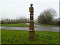
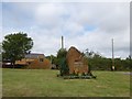
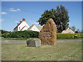
Wroxton, guidestone
At the junction of Stratford and North Newington Roads, a C17 guidestone, giving directions (with carved hands) to Banbury, Chiping Norton (sic), London, and Stratford; according to the last face, "First given by Mr. Fran White in 1686." Above the inscriptions are sundials, with the gnomons now missing, and a ball finial. Listed by English Heritage: http://www.imagesofengland.org.uk/details/default.aspx?id=244806
Image: © Mike Faherty
Taken: 3 Mar 2012
0.13 miles
7
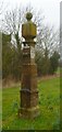
Old Guide Stone by the A422, North Newington Road, Wroxton parish
Francis White guidepost by the A422, in parish of Wroxton (Cherwell District), North Newington Road; Northwest edge of Wroxton Village, at junction with Stratford Road, on well cut, wide grassed area with hedge at back.
Grade II listed.
List Entry Number: 1369616 https://historicengland.org.uk/listing/the-list/list-entry/1369616
Surveyed
Milestone Society National ID: OX_XWRO
Image: © Mike Faherty
Taken: Unknown
0.13 miles
8
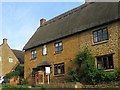
The Old Post Office, Wroxton
The former post office of this village, with a sundial above the door and the collection box still in use.
Image: © Richard Green
Taken: 14 May 2013
0.13 miles
9
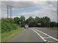
Approaching Wroxton
On the A422. Turning to North Newington off to the right.
Image: © andrew auger
Taken: 5 Jul 2010
0.13 miles