Wroxton, guidestone
Introduction
The photograph on this page of Wroxton, guidestone by Mike Faherty as part of the Geograph project.
The Geograph project started in 2005 with the aim of publishing, organising and preserving representative images for every square kilometre of Great Britain, Ireland and the Isle of Man.

There are currently over 7.5m images from over 14,400 individuals and you can help contribute to the project by visiting https://www.geograph.org.uk
Wroxton, guidestone
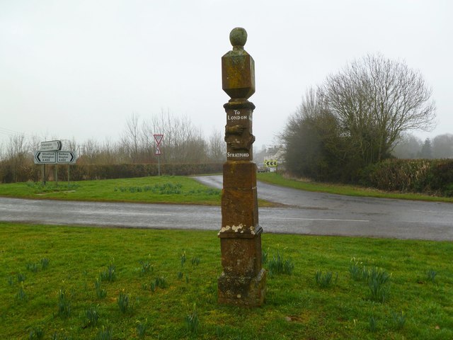
Image: © Mike Faherty Taken: 3 Mar 2012
At the junction of Stratford and North Newington Roads, a C17 guidestone, giving directions (with carved hands) to Banbury, Chiping Norton (sic), London, and Stratford; according to the last face, "First given by Mr. Fran White in 1686." Above the inscriptions are sundials, with the gnomons now missing, and a ball finial. Listed by English Heritage: http://www.imagesofengland.org.uk/details/default.aspx?id=244806
Images are licensed for reuse under creativecommons.org/licenses/by-sa/2.0
Image Location
Latitude
52.072075
Longitude
-1.40499