
IMAGES TAKEN NEAR TO
Stratford Road, BANBURY, OX15 6FF
Introduction
This page details the photographs taken nearby to Stratford Road, OX15 6FF by members of the Geograph project.
The Geograph project started in 2005 with the aim of publishing, organising and preserving representative images for every square kilometre of Great Britain, Ireland and the Isle of Man.

There are currently over 7.5m images from over14,400 individuals and you can help contribute to the project by visiting https://www.geograph.org.uk
Image Map
Images are licensed for reuse under creativecommons.org/licenses/by-sa/2.0
Notes
- Clicking on the map will re-center to the selected point.
- The higher the marker number, the further away the image location is from the centre of the postcode.
Image Listing (9 Images Found)
Images are licensed for reuse under creativecommons.org/licenses/by-sa/2.0
Image
Details
Distance
1
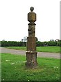
Wroxton - guide posts old and new
The 1686 guide post at the junction of a minor road with the A422, with a passing Banbury Run participant on the A422.
English Heritage grade II listed structure.
The other side: Image]
Detail: Image]
Image: © E Gammie
Taken: 18 Jun 2006
0.18 miles
2

Wroxton guide post
The guide post at Wroxton, looking towards the footpath opening (signpost in background) - "First given by Mr. Fran. White in the year 1686". There are various forms of sundial on each of the four sides of the top section, below the sphere.
English Heritage Grade II listed structure.
The other side: Image]
Image: © E Gammie
Taken: 18 Jun 2006
0.18 miles
3
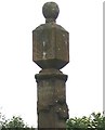
To Chiping Norton
Now known as Chipping Norton. Detail of 2 sides of the Wroxton guide post. The side to the right points rightwards to London and leftwards to Stratford.
Context: Image]
Image: © E Gammie
Taken: 18 Jun 2006
0.18 miles
4
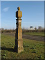
17th century Guide Post just outside Wroxton
An inscription on one face reads ‘First given by Mr Fran White in the year 1686’.
Image: © Richard Rogerson
Taken: 13 Mar 2010
0.21 miles
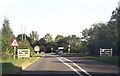
6
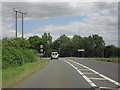
Approaching Wroxton
On the A422. Turning to North Newington off to the right.
Image: © andrew auger
Taken: 5 Jul 2010
0.23 miles
7
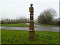
Wroxton, guidestone
At the junction of Stratford and North Newington Roads, a C17 guidestone, giving directions (with carved hands) to Banbury, Chiping Norton (sic), London, and Stratford; according to the last face, "First given by Mr. Fran White in 1686." Above the inscriptions are sundials, with the gnomons now missing, and a ball finial. Listed by English Heritage: http://www.imagesofengland.org.uk/details/default.aspx?id=244806
Image: © Mike Faherty
Taken: 3 Mar 2012
0.23 miles
8
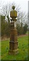
Old Guide Stone by the A422, North Newington Road, Wroxton parish
Francis White guidepost by the A422, in parish of Wroxton (Cherwell District), North Newington Road; Northwest edge of Wroxton Village, at junction with Stratford Road, on well cut, wide grassed area with hedge at back.
Grade II listed.
List Entry Number: 1369616 https://historicengland.org.uk/listing/the-list/list-entry/1369616
Surveyed
Milestone Society National ID: OX_XWRO
Image: © Mike Faherty
Taken: Unknown
0.23 miles
