
IMAGES TAKEN NEAR TO
Netting Close, BANBURY, OX15 5NN
Introduction
This page details the photographs taken nearby to Netting Close, OX15 5NN by members of the Geograph project.
The Geograph project started in 2005 with the aim of publishing, organising and preserving representative images for every square kilometre of Great Britain, Ireland and the Isle of Man.

There are currently over 7.5m images from over14,400 individuals and you can help contribute to the project by visiting https://www.geograph.org.uk
Image Map
Images are licensed for reuse under creativecommons.org/licenses/by-sa/2.0
Notes
- Clicking on the map will re-center to the selected point.
- The higher the marker number, the further away the image location is from the centre of the postcode.
Image Listing (246 Images Found)
Images are licensed for reuse under creativecommons.org/licenses/by-sa/2.0
Image
Details
Distance
1
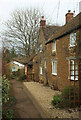
Shearing Close, Hook Norton
Footpath 253 17/10 passes the house on its descent to Watery Lane.
Image: © Derek Harper
Taken: 10 Feb 2022
0.02 miles
2
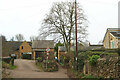
Watery Lane, Hook Norton
The lane becomes too narrow for vehicles as it approaches Netting Street, and the left turn is a footpath - 253 17/10.
Image: © Derek Harper
Taken: 10 Feb 2022
0.04 miles
3
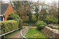
Path to Watery Lane, Hook Norton
Footpath 253 16/10 drops to meet the lane, with a play area on the far side.
Image: © Derek Harper
Taken: 10 Feb 2022
0.04 miles
4
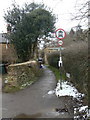
Watery Lane
Marked on the OS map as a road, rather than a byway, footpath or bridleway, the signs indicate that a horse and cart would be the only sort of vehicle permitted.
Image: © Alan Murray-Rust
Taken: 22 Feb 2010
0.04 miles
5
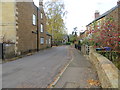
A part of High Street in Hook Norton
Looking westward.
Image: © Peter Wood
Taken: 10 Nov 2017
0.05 miles
6
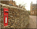
Postbox, Hook Norton
Elizabeth II postbox OX15 1002 is on Netting Street. Along on the right Netting Street becomes High Street, and the tall house is The Paddocks https://historicengland.org.uk/listing/the-list/list-entry/1369862?section=official-listing .
Image: © Derek Harper
Taken: 9 Feb 2022
0.05 miles
7

Postbox, Hook Norton
A closer look at the Elizabeth II postbox OX15 1002 shown in Image
Image: © Derek Harper
Taken: 9 Feb 2022
0.05 miles
8
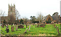
St Peter's churchyard, Hook Norton
Seen from footpath 253 17/10, with the grade I listed church https://historicengland.org.uk/listing/the-list/list-entry/1369840?section=official-list-entry and, on the right, the library / former school https://historicengland.org.uk/listing/the-list/list-entry/1376152?section=official-list-entry .
Image: © Derek Harper
Taken: 10 Feb 2022
0.05 miles
9

On High Street, Hook Norton
In shadow from this direction are the library and St Peters Church.
Image: © Derek Harper
Taken: 9 Feb 2022
0.05 miles
