IMAGES TAKEN NEAR TO
Upper Brailes, BANBURY, OX15 5BA
Introduction
This page details the photographs taken nearby to OX15 5BA by members of the Geograph project.
The Geograph project started in 2005 with the aim of publishing, organising and preserving representative images for every square kilometre of Great Britain, Ireland and the Isle of Man.

There are currently over 7.5m images from over14,400 individuals and you can help contribute to the project by visiting https://www.geograph.org.uk
Image Map
Images are licensed for reuse under creativecommons.org/licenses/by-sa/2.0
Notes
- Clicking on the map will re-center to the selected point.
- The higher the marker number, the further away the image location is from the centre of the postcode.
Image Listing (32 Images Found)
Images are licensed for reuse under creativecommons.org/licenses/by-sa/2.0
Image
Details
Distance
1
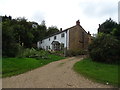
Grove End
"Three cottages, now house. Late C17 with C20 additions." https://historicengland.org.uk/listing/the-list/list-entry/1024378?section=official-list-entry .
Image: © Derek Harper
Taken: 1 Nov 2022
0.01 miles
2
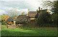
Henbrook Lane
A reverse of Image], showing the extension to Grove End Farm, listed as Henbrook Farmhouse https://historicengland.org.uk/listing/the-list/list-entry/1024379?section=official-list-entry .
Image: © Derek Harper
Taken: 1 Nov 2022
0.03 miles
3
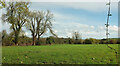
Grass field, Grove End
A view from Henbrook Lane. The tower of St. George's Church at Lower Brailes can be glimpsed between the trees; clearer views at https://www.geograph.org.uk/gridref/SP3139?centi=SP315393 .
Image: © Derek Harper
Taken: 1 Nov 2022
0.03 miles
4
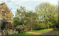
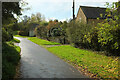
Henbrook Lane
On the left is the "2-storey C19 limestone extension" to Grove End Farm, listed as Henbrook Farmhouse https://historicengland.org.uk/listing/the-list/list-entry/1024379?section=official-list-entry .
Image: © Derek Harper
Taken: 1 Nov 2022
0.03 miles
5
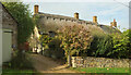
Grove End Farm
Listed as Henbrook Farmhouse https://historicengland.org.uk/listing/the-list/list-entry/1024379?section=official-list-entry .
Image: © Derek Harper
Taken: 1 Nov 2022
0.04 miles
6

Approaching Grove End
Grove End is a southern hamlet of Upper Brailes. Footpath 134 SS61c/1 crosses the stile on the right.
Image: © Derek Harper
Taken: 1 Nov 2022
0.07 miles
7

Upper Brailes
Seen from the footpath, a view of part of Upper Brailes. The building with the pointed arch windows is the Methodist chapel.
Image: © Michael Dibb
Taken: 26 Dec 2009
0.09 miles
8

Field, Upper Brailes
Footpath 134 SS61c/1 keeps to the right side of this field.
Image: © Derek Harper
Taken: 1 Nov 2022
0.09 miles
9
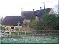
Thatch at Upper Brailes
At the start of the footpath in Grove End, Upper Brailes is this pleasant thatched property.
Image: © Michael Dibb
Taken: 26 Dec 2009
0.10 miles