
IMAGES TAKEN NEAR TO
Chapel Lane, BANBURY, OX15 4DB
Introduction
This page details the photographs taken nearby to Chapel Lane, OX15 4DB by members of the Geograph project.
The Geograph project started in 2005 with the aim of publishing, organising and preserving representative images for every square kilometre of Great Britain, Ireland and the Isle of Man.

There are currently over 7.5m images from over14,400 individuals and you can help contribute to the project by visiting https://www.geograph.org.uk
Image Map
Images are licensed for reuse under creativecommons.org/licenses/by-sa/2.0
Notes
- Clicking on the map will re-center to the selected point.
- The higher the marker number, the further away the image location is from the centre of the postcode.
Image Listing (72 Images Found)
Images are licensed for reuse under creativecommons.org/licenses/by-sa/2.0
Image
Details
Distance
1
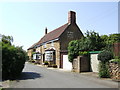
Horse and Jockey, Bodicote
One of few pubs still sporting a Courage sign (just!) although has not served a genuine pint of Courage Directors for many a year.
Image: © al partington
Taken: 11 May 2006
0.09 miles
2
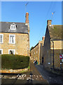
Chapel Lane, Bodicote
Very narrow at this end but widens out a short way along.
Image: © Des Blenkinsopp
Taken: 17 Dec 2018
0.09 miles
4
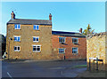
Junction of Broad Gap and High Street
One very common street name and one quite unusual one.
Image: © Des Blenkinsopp
Taken: 17 Dec 2018
0.09 miles
6
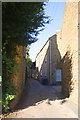
Chapel Lane from East Street
The house on the left is Draycott House (with an OS benchmark Image on the corner at the bottom left of the image) and the white door on the right is the entrance to Rhubarb Cottage
Image: © Roger Templeman
Taken: 29 Oct 2013
0.09 miles
7
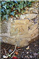
Benchmark on Draycott House, East Street
Ordnance Survey cut mark benchmark described on the Bench Mark Database at http://www.bench-marks.org.uk/bm52357
Image: © Roger Templeman
Taken: 29 Oct 2013
0.10 miles
8
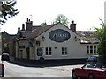
The Plough Inn, Bodicote
Former home of the Bodicote Brewery; sadly missed. Now under the Wadworth's flag having been a free house with the Blencoe family for nearly 50 years.
Image: © al partington
Taken: 11 May 2006
0.11 miles
9
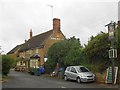
Bodicote: The Horse and Jockey
The Horse and Jockey is down Malthouse Lane. The Courage sign mentioned in the description for Image has now completely gone, along with the rest of the then existing pub sign name on the flank wall.
Incidentally the 1882 large scale Ordnance Survey map of the village calls it Boddicot throughout.
Image: © Nigel Cox
Taken: 27 Jul 2015
0.12 miles
10
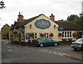
Bodicote: The Plough
The Plough is on the High Street, at the junction with Goose Lane off to the right.
From a Geograph point of view the 446000 Easting grid line virtually runs down the ridgeline of the building, so anything to the right is actually in Image
Image: © Nigel Cox
Taken: 27 Jul 2015
0.12 miles