Bodicote: The Horse and Jockey
Introduction
The photograph on this page of Bodicote: The Horse and Jockey by Nigel Cox as part of the Geograph project.
The Geograph project started in 2005 with the aim of publishing, organising and preserving representative images for every square kilometre of Great Britain, Ireland and the Isle of Man.

There are currently over 7.5m images from over 14,400 individuals and you can help contribute to the project by visiting https://www.geograph.org.uk
Bodicote: The Horse and Jockey
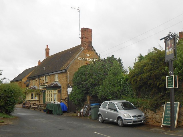
Image: © Nigel Cox Taken: 27 Jul 2015
The Horse and Jockey is down Malthouse Lane. The Courage sign mentioned in the description for Image has now completely gone, along with the rest of the then existing pub sign name on the flank wall. Incidentally the 1882 large scale Ordnance Survey map of the village calls it Boddicot throughout.
Images are licensed for reuse under creativecommons.org/licenses/by-sa/2.0
Image Location
Latitude
52.037336
Longitude
-1.331393