
IMAGES TAKEN NEAR TO
Riley Close, ABINGDON, OX14 5RR
Introduction
This page details the photographs taken nearby to Riley Close, OX14 5RR by members of the Geograph project.
The Geograph project started in 2005 with the aim of publishing, organising and preserving representative images for every square kilometre of Great Britain, Ireland and the Isle of Man.

There are currently over 7.5m images from over14,400 individuals and you can help contribute to the project by visiting https://www.geograph.org.uk
Image Map
Images are licensed for reuse under creativecommons.org/licenses/by-sa/2.0
Notes
- Clicking on the map will re-center to the selected point.
- The higher the marker number, the further away the image location is from the centre of the postcode.
Image Listing (47 Images Found)
Images are licensed for reuse under creativecommons.org/licenses/by-sa/2.0
Image
Details
Distance
1

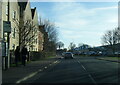
Benchmark on #31 Caldecott Road
Ordnance Survey cut mark benchmark described on the Bench Mark Database at http://www.bench-marks.org.uk/bm22929
Image: © Roger Templeman
Taken: 28 Sep 2010
0.07 miles
4
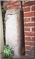
Old Bridge Marker by the B4017, Drayton Road, Abingdon
Bridge Marker by the B4017, in parish of Abingdon (Vale Of White Horse District), Drayton Road; opposite Ladygrove Court, before petrol station, against brick wall on the pavement, behind lamppost, West side of road.
Surveyed
Milestone Society National ID: BE_ABNE01br
Image: © Milestone Society
Taken: Unknown
0.10 miles
5
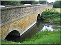
River Ock: Ock Bridge in Abingdon
Ock Bridge is a medieval bridge, built on the site of a former ford and characterized by its long approach causeway. A barrel vault in one of the arches has been dated to possibly as early as 1100 AD. The bridge was rebuilt in the 15th century, widened in the 18th century, and widened again in 1979 to 1980. Today it carries the B4017 Drayton Road over the river.
Image: © Nigel Cox
Taken: 31 Aug 2007
0.11 miles
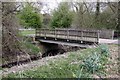
7
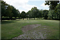
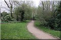
Maintained grass near Ock Meadow
Not all of the land in the Ock Valley is maintained like this, and some is a nature reserve. This land allows access along the valley.
Image: © Bill Boaden
Taken: 17 Jul 2020
0.13 miles
8
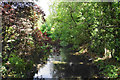
River Ock
Passing through Abingdon. This is looking downstream from Ock Bridge.
Image: © Bill Boaden
Taken: 17 Jul 2020
0.14 miles
10
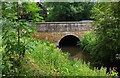
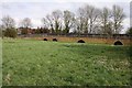
River Ock and Ock Bridge, Abingdon, Oxon
The bridge takes the B4017 Drayton Road across the River Ock. The bridge dates from medieval times but has been much altered and widened over the centuries.
Image: © P L Chadwick
Taken: 20 Jul 2014
0.16 miles