River Ock: Ock Bridge in Abingdon
Introduction
The photograph on this page of River Ock: Ock Bridge in Abingdon by Nigel Cox as part of the Geograph project.
The Geograph project started in 2005 with the aim of publishing, organising and preserving representative images for every square kilometre of Great Britain, Ireland and the Isle of Man.

There are currently over 7.5m images from over 14,400 individuals and you can help contribute to the project by visiting https://www.geograph.org.uk
River Ock: Ock Bridge in Abingdon
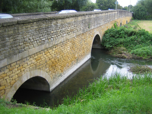
Image: © Nigel Cox Taken: 31 Aug 2007
Ock Bridge is a medieval bridge, built on the site of a former ford and characterized by its long approach causeway. A barrel vault in one of the arches has been dated to possibly as early as 1100 AD. The bridge was rebuilt in the 15th century, widened in the 18th century, and widened again in 1979 to 1980. Today it carries the B4017 Drayton Road over the river.
Images are licensed for reuse under creativecommons.org/licenses/by-sa/2.0
Image Location


Leaflet Map data © OpenStreetMap
Latitude
51.667865
Longitude
-1.295779