
IMAGES TAKEN NEAR TO
Caldecott Road, ABINGDON, OX14 5EP
Introduction
This page details the photographs taken nearby to Caldecott Road, OX14 5EP by members of the Geograph project.
The Geograph project started in 2005 with the aim of publishing, organising and preserving representative images for every square kilometre of Great Britain, Ireland and the Isle of Man.

There are currently over 7.5m images from over14,400 individuals and you can help contribute to the project by visiting https://www.geograph.org.uk
Image Map
Images are licensed for reuse under creativecommons.org/licenses/by-sa/2.0
Notes
- Clicking on the map will re-center to the selected point.
- The higher the marker number, the further away the image location is from the centre of the postcode.
Image Listing (407 Images Found)
Images are licensed for reuse under creativecommons.org/licenses/by-sa/2.0
Image
Details
Distance
1
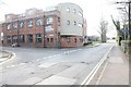
Caldicott Road
View of Caldicott Road and the old laundry on the left.
Image: © Bill Nicholls
Taken: 20 Mar 2011
0.02 miles
2
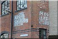
Writing on the wall
Some old advertising left on a building along Wilsham Road in Abingdon.
Image: © Bill Nicholls
Taken: 20 Mar 2011
0.02 miles
3
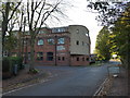
Approaching the junction of St Helen's Wharf and Wilsham Road
Image: © Basher Eyre
Taken: 29 Oct 2013
0.03 miles
4
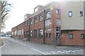
Building on Wilsham Road
This building used to be an old Laundry at one time now it is converted to flats.
Image: © Bill Nicholls
Taken: 20 Mar 2011
0.03 miles
5
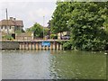
Pilings in the entrance
The pilings you see on the opposite side of the Thames here at Abingdon mark the point where the Wilts & Berks canal joined the Thames. Lot of history lost there.
Image: © Bill Nicholls
Taken: 22 Jun 2014
0.03 miles
6
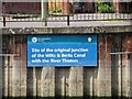
Notice on the Side
The notice marks the junction of the Wilts & Berks canal at Abingdon, the pilings cross the entrance. From here you would have gone to a wharf and basin.
Image: © Bill Nicholls
Taken: 22 Jun 2014
0.03 miles
7
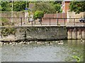
An Old Wall
This I am presuming is part of the original wall of the junction to the Wilts & Berks canal at Abingdon as it curves in the right direction to where the wharf would have been.
Image: © Bill Nicholls
Taken: 22 Jun 2014
0.03 miles
8
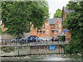
The Wharf
Over one hundred years ago you would be looking into the wharf of the Abingdon end of the Wilts & Berks Canal. Houses have now been built on the basin.
Image: © Bill Nicholls
Taken: 22 Jun 2014
0.03 miles
9
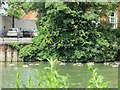
Hidden in the shrubbery
The other side of the junction to the Wilts & Berks canal at Abingdon is hidden behind the shrubbery here.
Image: © Bill Nicholls
Taken: 22 Jun 2014
0.04 miles
10
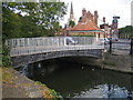
River Ock in Abingdon
This is the River Ock very close (10 metres) to its confluence with the River Thames. The bridge carries the road from St Helen's Wharf, to the right of the photo, to Caldecott Road. The text on the girderwork of the bridge is a reminder that this was the start of the former Wilts and Berks Canal to Swindon and Melksham with spurs to Cricklade, Calne, and Chippenham. The Old Anchor Inn on St Helen's Wharf is to the right while the steeple of St Helen's Church is visible in the distance.
Image: © Nigel Cox
Taken: 3 Sep 2007
0.04 miles