The Wharf
Introduction
The photograph on this page of The Wharf by Bill Nicholls as part of the Geograph project.
The Geograph project started in 2005 with the aim of publishing, organising and preserving representative images for every square kilometre of Great Britain, Ireland and the Isle of Man.

There are currently over 7.5m images from over 14,400 individuals and you can help contribute to the project by visiting https://www.geograph.org.uk
The Wharf
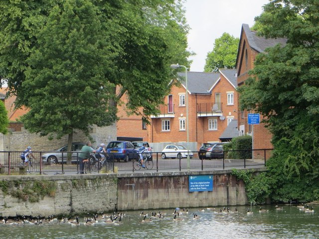
Image: © Bill Nicholls Taken: 22 Jun 2014
Over one hundred years ago you would be looking into the wharf of the Abingdon end of the Wilts & Berks Canal. Houses have now been built on the basin.
Images are licensed for reuse under creativecommons.org/licenses/by-sa/2.0
Image Location
Latitude
51.665908
Longitude
-1.284531