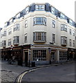
IMAGES TAKEN NEAR TO
Market Street, OXFORD, OX1 3EQ

Introduction

This page details the photographs taken nearby to Market Street, OX1 3EQ by members of the Geograph project.

The Geograph project started in 2005 with the aim of publishing, organising and preserving representative images for every square kilometre of Great Britain, Ireland and the Isle of Man.

There are currently over 7.5m images from over14,400 individuals and you can help contribute to the project by visiting https://www.geograph.org.uk

Image Map


Images are licensed for reuse under creativecommons.org/licenses/by-sa/2.0
Notes
  • Clicking on the map will re-center to the selected point.
  • The higher the marker number, the further away the image location is from the centre of the postcode.

Image Listing (3073 Images Found)

Images are licensed for reuse under creativecommons.org/licenses/by-sa/2.0
  • ...
Image
Details
Distance
1
Celebrations in Oxford
Party shop on the corner of Market Street and Turl Street.
Image: © Jaggery Taken: 19 Oct 2014
0.00 miles
2
Oxford, Jesus College
The pictured angle at the junction of Market Street and Turl Street was the location of a cut bench mark, now lost to stonework replacement. See http://www.bench-marks.org.uk/bm26620 for details of the lost mark.
Image: © Brian Westlake Taken: 17 Aug 2017
0.00 miles
3
Runaya, Turl Street
What is now a beauty and nail bar, and a few years earlier a 'party shop' Image, occupies what was a cycle shop when I was a student in the 1980s. Note the name 'Lincoln House' above the door: since 1950 the upper storeys have been student accommodation for the college of the same name across the road. The building dates from 1939, architects J Hubert Worthington and Gilbert Gardner (the former being Slade Lecturer in architecture at Oxford University and responsible for several other buildings in the city). Source: 'Lincoln College', in A History of the County of Oxford: Volume 3, the University of Oxford, ed. H E Salter and Mary D Lobel (London, 1954), pp. 163-173. British History Online http://www.british-history.ac.uk/vch/oxon/vol3/pp163-173 [accessed 24 February 2022].
Image: © Stephen Craven Taken: 21 Sep 2021
0.00 miles
4
Market Street - Turl Street
Image: © Betty Longbottom Taken: 11 Aug 2013
0.00 miles
5
Looking from Brasenose Lane into Turl Street
Image: © Basher Eyre Taken: 9 Apr 2011
0.01 miles
6
Junction of Turl Street and Market Street
Image: © Basher Eyre Taken: 11 Apr 2015
0.01 miles
7
Old Boundary Marker on Turl Street, Oxford
Parish Boundary Marker inscribed at ground level in the outside wall of a shop on the west side of Turl Street, Oxford OX1 3DL. On the boundary of All Saints and St Michael at the Northgate. See also http://www.oxfordhistory.org.uk/streets/parish_marks/st_michael_boundary_markers.html and http://www.oxfordhistory.org.uk/images/images_streets/parish_marks/turl_street.jpg. Milestone Society National ID: OX_OX17pb
Image: © Roadside Relics Taken: 4 Aug 2023
0.01 miles
8
Jesus College at Market Street / Turl Street junction
An Ordnance Survey cut mark benchmark, described on the Bench Mark Database at www.bench-marks.org.uk/bm26620, on the corner of the building where the bicycle is secured has been lost to repairs of the stonework
Image: © Roger Templeman Taken: 20 Feb 2019
0.01 miles
9
Looking towards a postbox in Turl Street
Image: © Basher Eyre Taken: 9 Apr 2011
0.01 miles
10
North-west corner of Lincoln College
This north end of the original 15th century college building was erected on the site of the ancient church of St Mildred. Source: 'Lincoln College', in A History of the County of Oxford: Volume 3, the University of Oxford, ed. H E Salter and Mary D Lobel (London, 1954), pp. 163-173. British History Online http://www.british-history.ac.uk/vch/oxon/vol3/pp163-173 [accessed 24 February 2022].
Image: © Stephen Craven Taken: 21 Sep 2021
0.01 miles
  • ...