Old Boundary Marker on Turl Street, Oxford
Introduction
The photograph on this page of Old Boundary Marker on Turl Street, Oxford by Roadside Relics as part of the Geograph project.
The Geograph project started in 2005 with the aim of publishing, organising and preserving representative images for every square kilometre of Great Britain, Ireland and the Isle of Man.

There are currently over 7.5m images from over 14,400 individuals and you can help contribute to the project by visiting https://www.geograph.org.uk
Old Boundary Marker on Turl Street, Oxford
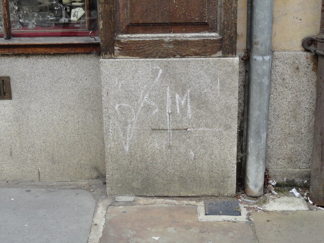
Image: © Roadside Relics Taken: 4 Aug 2023
Parish Boundary Marker inscribed at ground level in the outside wall of a shop on the west side of Turl Street, Oxford OX1 3DL. On the boundary of All Saints and St Michael at the Northgate. See also http://www.oxfordhistory.org.uk/streets/parish_marks/st_michael_boundary_markers.html and http://www.oxfordhistory.org.uk/images/images_streets/parish_marks/turl_street.jpg. Milestone Society National ID: OX_OX17pb
Images are licensed for reuse under creativecommons.org/licenses/by-sa/2.0
Image Location
Latitude
51.753245
Longitude
-1.256221