IMAGES TAKEN NEAR TO
Sheepwash Lane, ABINGDON, OX13 6SD
Introduction
This page details the photographs taken nearby to Sheepwash Lane, OX13 6SD by members of the Geograph project.
The Geograph project started in 2005 with the aim of publishing, organising and preserving representative images for every square kilometre of Great Britain, Ireland and the Isle of Man.

There are currently over 7.5m images from over14,400 individuals and you can help contribute to the project by visiting https://www.geograph.org.uk
Image Map
Images are licensed for reuse under creativecommons.org/licenses/by-sa/2.0
Notes
- Clicking on the map will re-center to the selected point.
- The higher the marker number, the further away the image location is from the centre of the postcode.
Image Listing (87 Images Found)
Images are licensed for reuse under creativecommons.org/licenses/by-sa/2.0
Image
Details
Distance
1
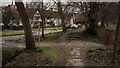
The causeway and Home Farm, Steventon
Here the break in the causeway for an access to the village green is itself cobbled. The causeway path east of the break is flagged rather than cobbled, though cobbles resume along the lower level Milton Lane footpath out of the village.
Image: © Chris Brown
Taken: 19 Feb 2017
0.09 miles
2
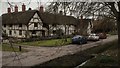
Green Farm in Milton Lane, Steventon
This large rambling timber-framed building makes a fine focus for the eastern corner of Steventon's large green. Seen from the causeway with one of the ditches of the Ginge Brook in the foreground.
Image: © Chris Brown
Taken: 19 Feb 2017
0.09 miles
3
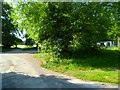
The Orange Way after Wiltshire (153)
The right turn along Milton Lane (a bridleway) is taken now.
Image: © Shazz
Taken: 7 Jul 2013
0.10 miles
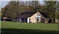
5
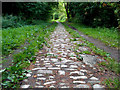
Cobblestones on Milton Lane
Milton Lane is a bridleway between Milton and Steventon.
I'm guessing in horse and cart days it was the main route between the two villages and the road was made up accordingly with this hard surface.
The same trip by road now, post A34, is a three sides of the square rigmarole of junctions, lights and roundabouts.
Making a road like this would have been more of an enterprise than it looks because suitably hard roadstone doesn't occur locally.
This surface extends for a couple of hundred metres east of here and then the path becomes quite narrow. Where it runs beside the Ginge Brook it is in danger of being eroded away.
Image: © Des Blenkinsopp
Taken: 3 Aug 2011
0.12 miles
6
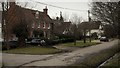
Milton Lane, Steventon
Along the eastern section of the causeway, the roadway is known as Milton Lane. The handsome early 18th century brick house seen from the elevation offered by the causeway is Home Farm and the older whitewashed house beyond is Colts Close.
Image: © Chris Brown
Taken: 19 Feb 2017
0.13 miles
7
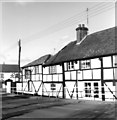
Steventon
The Cherry Tree pub. An brazenly anti-digital image, taken in black and white on an entirely mechanical 1960s Mamiya C220. Look ma, no batteries!
Image: © Rosalind Mitchell
Taken: 19 Feb 2005
0.13 miles
8
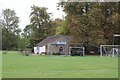
Club on The Green
Sports and social club on The Green at Steventon.
Image: © Bill Nicholls
Taken: 7 Sep 2011
0.14 miles