IMAGES TAKEN NEAR TO
WANTAGE, OX12 9BE
Introduction
This page details the photographs taken nearby to OX12 9BE by members of the Geograph project.
The Geograph project started in 2005 with the aim of publishing, organising and preserving representative images for every square kilometre of Great Britain, Ireland and the Isle of Man.

There are currently over 7.5m images from over14,400 individuals and you can help contribute to the project by visiting https://www.geograph.org.uk
Image Map (Loading...)


Getting Data...Please wait
Leaflet Map data © OpenStreetMap
Images are licensed for reuse under creativecommons.org/licenses/by-sa/2.0
Notes
- Clicking on the map will re-center to the selected point.
- The higher the marker number, the further away the image location is from the centre of the postcode.
Image Listing (40 Images Found)
Images are licensed for reuse under creativecommons.org/licenses/by-sa/2.0
Image
Details
Distance
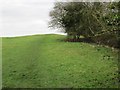
1
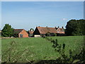
Stockham Farm
Looking NE.In NW quarter of grid square.
Image: © Alec Samler
Taken: 24 Sep 2004
0.02 miles
2
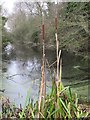
Bulrushes on the edge
A couple of bulrushes stand on the edge of the old Wilts and Berks canal near Grove airfield
Image: © Bill Nicholls
Taken: 13 Dec 2009
0.08 miles
3
Canal again
I have a feeling the canal was just filled in behind me rather than a bridge being there as the canal starts again straight away past the footpath
Image: © Bill Nicholls
Taken: 13 Dec 2009
0.09 miles
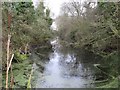
4
Canal in the cutting
The canal runs through a cutting near Grove airfield which must have taken considerable work to do
Image: © Bill Nicholls
Taken: 13 Dec 2009
0.09 miles
5
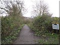
Back to Wantage
This path leads back to the Belmont area of Wantage
Image: © Bill Nicholls
Taken: 13 Dec 2009
0.10 miles
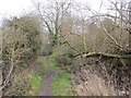
6
Footpath uphill
It's not possible to follow the towpath as it's fenced off and quite dangerous by the canal so it goes this way uphill near Grove airfield.
Image: © Bill Nicholls
Taken: 13 Dec 2009
0.10 miles
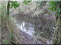
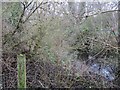
7
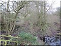
Trees in the canal
The end of the canal near Grove airfield with the brickwork to the left. It looks suspiciously like a filled in lock.
Image: © Bill Nicholls
Taken: 13 Dec 2009
0.10 miles
8
Stile in the distance
A stile marks the end of this section of towpath before we reach an access road for Grove airfield. To the right is where the canal is supposed to be.
Image: © Bill Nicholls
Taken: 13 Dec 2009
0.11 miles
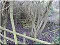
9
Fenced off and overgrown
The fenced off and overgrown area near the footpath heading to Grove. Fenced off to stop livestock wandering in no doubt.
Image: © Bill Nicholls
Taken: 13 Dec 2009
0.11 miles
10
Brickwork near the canal
This needed further investigation as we spotted brickwork round by the end of the canal near Grove airfield.
Image: © Bill Nicholls
Taken: 13 Dec 2009
0.11 miles