
IMAGES TAKEN NEAR TO
Fraser Gardens, WALLINGFORD, OX10 9BL
Introduction
This page details the photographs taken nearby to Fraser Gardens, OX10 9BL by members of the Geograph project.
The Geograph project started in 2005 with the aim of publishing, organising and preserving representative images for every square kilometre of Great Britain, Ireland and the Isle of Man.

There are currently over 7.5m images from over14,400 individuals and you can help contribute to the project by visiting https://www.geograph.org.uk
Image Map
Images are licensed for reuse under creativecommons.org/licenses/by-sa/2.0
Notes
- Clicking on the map will re-center to the selected point.
- The higher the marker number, the further away the image location is from the centre of the postcode.
Image Listing (97 Images Found)
Images are licensed for reuse under creativecommons.org/licenses/by-sa/2.0
Image
Details
Distance
1
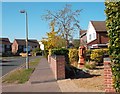
Easter Island, OX10
A wooden statue in someone's garden.
Image: © Des Blenkinsopp
Taken: 15 Oct 2011
0.06 miles
2
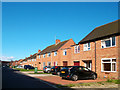
Barley Close, Wallingford
Just an ordinary residential street, but the name recalls the large malting works that used to be on the other side of the road and was the reason the old Wallingford rail line, now preserved as the Cholsey and Wallingford Railway, survived closure to passengers.
When the maltings closed the main building was blown up by the demolishers in a controlled explosion watched by half the town. New housing is now on the site.
Image: © Des Blenkinsopp
Taken: 6 Oct 2011
0.10 miles
3
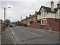
Towards St Johns Terrace
View along St John's road in Wallingford with St John's Terrace just past the white house on the right. First house has a flush bracket benchmark. Image
Image: © Bill Nicholls
Taken: 21 Jan 2012
0.13 miles
4
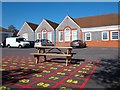
A Choice of Tables
Times tables or picnic tables. You choose. I know which I prefer.
This is the schoolyard at St Johns Primary, Wallingford, which recently celebrated its centenary.
http://www.stjohns100.co.uk/
Image: © Des Blenkinsopp
Taken: 15 Oct 2011
0.13 miles
5
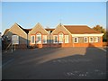
Back of St John's
Had to drop my son off at a rehearsal taking place at the school so it seemed rude not to get a photo of the school. The right hand wing is a new extension to the school.
Image: © Bill Nicholls
Taken: 19 Nov 2011
0.13 miles
6
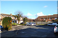
Trenchard Close, Wallingford
One of many residential no through roads in the newer part of town.
Image: © Des Blenkinsopp
Taken: 19 Jan 2014
0.14 miles
7

Field at Winterbrook
Farmland, for now, on the southern edge of Wallingford.
This will probably be a building site soon, unless the gravel diggers get there first.
Image: © Des Blenkinsopp
Taken: 22 Jan 2021
0.14 miles
8
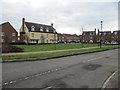
Sovereign Place
Sovereign Place where the ABM later Pauls Malt used to be. The social club used to be around in the foreground.
Image: © Bill Nicholls
Taken: 21 Jan 2012
0.14 miles
9
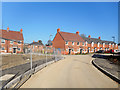
New Houses, Winterbrook
New housing off Reading Road.
Image: © Des Blenkinsopp
Taken: 24 Feb 2019
0.14 miles
10
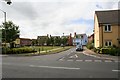
Sovereign Place
This is built on the old Paul's Malt building though this area on the right was probably where the sports and social club was.
Image: © Bill Nicholls
Taken: 28 Jun 2008
0.14 miles