
IMAGES TAKEN NEAR TO
Lodden Avenue, WALLINGFORD, OX10 7PY
Introduction
This page details the photographs taken nearby to Lodden Avenue, OX10 7PY by members of the Geograph project.
The Geograph project started in 2005 with the aim of publishing, organising and preserving representative images for every square kilometre of Great Britain, Ireland and the Isle of Man.

There are currently over 7.5m images from over14,400 individuals and you can help contribute to the project by visiting https://www.geograph.org.uk
Image Map
Images are licensed for reuse under creativecommons.org/licenses/by-sa/2.0
Notes
- Clicking on the map will re-center to the selected point.
- The higher the marker number, the further away the image location is from the centre of the postcode.
Image Listing (45 Images Found)
Images are licensed for reuse under creativecommons.org/licenses/by-sa/2.0
Image
Details
Distance
1
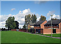
Roman Road out the Back
Footpath on the course of the Roman Road.
Looks a bit boring,really.
Image: © Des Blenkinsopp
Taken: 7 Oct 2010
0.04 miles
2
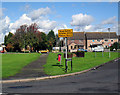
The Roman Road enters Berinsfield
That's it, going across the grass. The Dorchester to Bicester highway.
That orange car is blocking it.
Give him a ticket, Brutus....
Image: © Des Blenkinsopp
Taken: 7 Oct 2010
0.09 miles
3
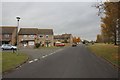
Fane Drive
Fane Drive in Berinsfield which I think may have been built on the old perimeter road of Mount farm airfield.
Image: © Bill Nicholls
Taken: 30 Oct 2011
0.10 miles
4
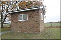
Pump House on Fane Drive
An old Thames Water pump house on Fane Drive Berinsfield where I spotted a benchmark on the right hand corner
Image: © Bill Nicholls
Taken: 30 Oct 2011
0.10 miles
5
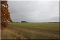
Farmland at Mount Farm
View across the farmland towards Mount Farm near Berinsfield, this used to be an airfield in the second world war.
Image: © Bill Nicholls
Taken: 30 Oct 2011
0.11 miles
6
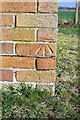
Benchmark on sewage pumping station building, Vane Drive
Ordnance Survey cut mark benchmark described on the Bench Mark Database at http://www.bench-marks.org.uk/bm22110
Image: © Roger Templeman
Taken: 30 Mar 2012
0.13 miles
7
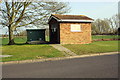
Sewage pumping station, Vane Drive
There is an OS benchmark Image on the right front corner of the hut.
Image: © Roger Templeman
Taken: 30 Mar 2012
0.13 miles
8
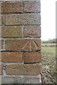
Benchmark on Fane drive
The benchmark on the pump house along Fane Drive in Berinsfield. Image
Image: © Bill Nicholls
Taken: 30 Oct 2011
0.13 miles
9
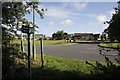
Out across the road
View from the old Roman road towards Berinsfield where it carries on through.
Image: © Bill Nicholls
Taken: 1 Jul 2012
0.14 miles
10
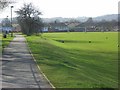
Recreation ground, Berinsfield
A large green space surrounded by the modern village. The path is a bridleway and the Roman road heading south to Dorchester.
Image: © Andrew Smith
Taken: 1 Mar 2008
0.15 miles