
IMAGES TAKEN NEAR TO
Greenmere, WALLINGFORD, OX10 0QL
Introduction
This page details the photographs taken nearby to Greenmere, OX10 0QL by members of the Geograph project.
The Geograph project started in 2005 with the aim of publishing, organising and preserving representative images for every square kilometre of Great Britain, Ireland and the Isle of Man.

There are currently over 7.5m images from over14,400 individuals and you can help contribute to the project by visiting https://www.geograph.org.uk
Image Map
Images are licensed for reuse under creativecommons.org/licenses/by-sa/2.0
Notes
- Clicking on the map will re-center to the selected point.
- The higher the marker number, the further away the image location is from the centre of the postcode.
Image Listing (90 Images Found)
Images are licensed for reuse under creativecommons.org/licenses/by-sa/2.0
Image
Details
Distance
1
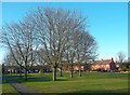
Greenmere, Brightwell
Greenmere is an area of houses from the 1940s and 50s to the north of the old Brightwell village.
Although Brightwell-cum-Sotwell is the full name of the village, I've not heard anyone say they're from Sotwell. It's always just Brightwell.
Originally two separate villages they have been linked for a long time.
Some history on http://en.wikipedia.org/wiki/Brightwell-cum-Sotwell
Image: © Des Blenkinsopp
Taken: 9 Dec 2011
0.02 miles
2
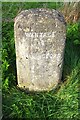
Milestone on NE side of High Road, Brightwell-cum-Sotwell
The stone shows mile distances as Wantage 12, Wallingford 2
Image: © Roger Templeman
Taken: 21 Mar 2020
0.06 miles
3
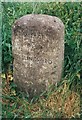
Old Milestone by High Road, Brightwell-cum-Sotwell
Carved stone post by High Road, former A4130, in parish of BRIGHTWELL CUM SOTWELL (SOUTH OXFORDSHIRE District), Sotwell Village, 30m West of Greenmere estate, on wide well kept grass bank, opposite bus shelter, on North side of road. Didcot pillar, erected by the Wallingford, Wantage & Faringdon turnpike trust in the 19th century.
Inscription reads:-
WANTAGE
12
WALLINGFORD
2
Grade II Listed. List Entry Number: 1059639
https://historicengland.org.uk/listing/the-list/list-entry/1059639
Milestone Society National ID: BE_WAWL12.
Image: © A Rosevear
Taken: 15 Sep 2001
0.07 miles
4
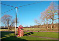
Phone Box and Post Box, Brightwell
The Phone doesn't work any more.
Image: © Des Blenkinsopp
Taken: 9 Dec 2011
0.07 miles
5
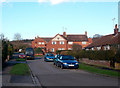
Roman Road, Greenmere, Brightwell
This is reputedly on the line of a Roman road between Dorchester and Silchester.
By comparison with other Roman highways there's not much left of this one.
Some field boundaries and a footpath over the Clumps just north of here, then this short bit of road and some more paths through Brightwell and onto the best bit, Mackney Lane, running for just over 1km south of the village before the line is lost.
Image: © Des Blenkinsopp
Taken: 9 Dec 2011
0.07 miles
6
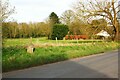
High Road, Brightwell-cum-Sotwell, Oxfordshire
There is a milestone Image in the road verge
Image: © Roger Templeman
Taken: 21 Mar 2020
0.08 miles
7
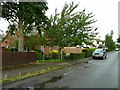
High Road, Brightwell-cum-Sotwell
A mixture of village house styles along this road.
Image: © Jonathan Billinger
Taken: 5 Aug 2008
0.08 miles
8
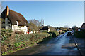
Cottage on High Road
The northern edge of Brightwell-cum-Sotwell. This road used to be the main road.
Image: © Bill Boaden
Taken: 27 Dec 2020
0.10 miles
9
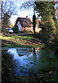
Snail Cottage and the Wellsprings
One of a series of springs along here at the foot of the Sinodun Hills, this is one of several sources of the Mackney Brook, a disorganized sort of stream which makes its way via a series of diversions and side channels into the Mill Brook, eventually reaching the Thames at Wallingford.
Image: © Des Blenkinsopp
Taken: 8 Dec 2011
0.11 miles
10
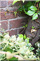
Benchmark on Spring Cottage
Ordnance Survey cut mark described on the Bench Mark Database at http://www.bench-marks.org.uk/bm23115
Image: © Roger Templeman
Taken: 2 Sep 2015
0.11 miles