IMAGES TAKEN NEAR TO
Porter Street, OLDHAM, OL9 7FF
Introduction
This page details the photographs taken nearby to Porter Street, OL9 7FF by members of the Geograph project.
The Geograph project started in 2005 with the aim of publishing, organising and preserving representative images for every square kilometre of Great Britain, Ireland and the Isle of Man.

There are currently over 7.5m images from over14,400 individuals and you can help contribute to the project by visiting https://www.geograph.org.uk
Image Map
Images are licensed for reuse under creativecommons.org/licenses/by-sa/2.0
Notes
- Clicking on the map will re-center to the selected point.
- The higher the marker number, the further away the image location is from the centre of the postcode.
Image Listing (13 Images Found)
Images are licensed for reuse under creativecommons.org/licenses/by-sa/2.0
Image
Details
Distance
1
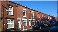
Albert Street, Chadderton
Albert Street is a suburban residential street in eastern Chadderton in Greater Manchester, England. It is composed of red-brick terraced houses, a traditional housing style in this area.
Image: © Steven Haslington
Taken: 1 Nov 2015
0.07 miles
2
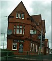
The Smut Inn
On Manchester Road, Oldham.
Image: © Matthew Hatton
Taken: 29 Aug 2009
0.14 miles
3
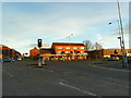
Junction of Spencer Street with Manchester Road, Oldham
Image: © Alexander P Kapp
Taken: 28 Nov 2012
0.15 miles
4
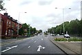
A62 approaching the Heron Street Junction
Image: © Anthony Parkes
Taken: 23 Jul 2012
0.15 miles
5
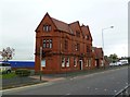
Hollinwood, Smut Inn
With a handsome terracotta facade, but sadly shut, and signage removed.
Image: © Mike Faherty
Taken: 19 Sep 2011
0.15 miles
6
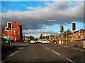
A62, Manchester Rd
The A62, Manchester Road, at its junction with Spencer Street; between Hollinwood and Werneth, travelling towards Oldham.
Image: © David Dixon
Taken: 27 Jan 2011
0.16 miles
7
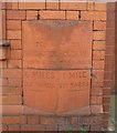
Old Milestone by Manchester Road, Hollinwood, Oldham parish
Fired terracotta distance marker by the A62, in parish of OLDHAM (OLDHAM District), Manchester Road, Hollinwood, built into East wall of Smut Inn, on West side of road. (A memorial stone company in 2021). The Smut Inn was erected by Boddingtons brewery in 1884, the distance marker would have been a special commission when the bricks were ordered to build the inn. https://manchestervictorianarchitects.org.uk/buildings/smut-inn-public-house-oldham
Inscription reads:-
: TO / MANCHESTER / TOWN HALL / 6 MILES / 32 YARDS / {line} : : HOLLINWOOD : : TO / OLDHAM / TOWN HALL / 1 MILE / 721 YARDS / {line} :
Milestone Society National ID: LA_MAOL06a.
Image: © M Faherty
Taken: 19 Sep 2011
0.16 miles
8
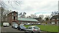
Bridge Works
A build of 1909 now occupied by Waterton Laser Profiling on Raymond Avenue. The works backs on to the Metrolink line near South Chadderton station.
Image: © Kevin Waterhouse
Taken: 17 Mar 2023
0.18 miles
9
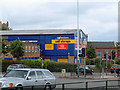
Manchester Road, A62, Oldham
Looking from the end of Stanley Road. The A62 here is heading south (right of shot) from Oldham town centre towards junction 22 on the M60 at Hollinwood. St Margaret's church tower can be seen behind the self-storage warehouse.
Image: © michael ely
Taken: 9 Jul 2008
0.20 miles