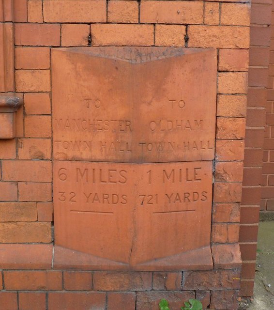
Old Milestone by Manchester Road, Hollinwood, Oldham parish
Introduction
The photograph on this page of Old Milestone by Manchester Road, Hollinwood, Oldham parish by M Faherty as part of the Geograph project.
The Geograph project started in 2005 with the aim of publishing, organising and preserving representative images for every square kilometre of Great Britain, Ireland and the Isle of Man.
There are currently over 7.5m images from over 14,400 individuals and you can help contribute to the project by visiting https://www.geograph.org.uk

Image: © M Faherty Taken: 19 Sep 2011
Fired terracotta distance marker by the A62, in parish of OLDHAM (OLDHAM District), Manchester Road, Hollinwood, built into East wall of Smut Inn, on West side of road. (A memorial stone company in 2021). The Smut Inn was erected by Boddingtons brewery in 1884, the distance marker would have been a special commission when the bricks were ordered to build the inn. https://manchestervictorianarchitects.org.uk/buildings/smut-inn-public-house-oldham Inscription reads:- : TO / MANCHESTER / TOWN HALL / 6 MILES / 32 YARDS / {line} : : HOLLINWOOD : : TO / OLDHAM / TOWN HALL / 1 MILE / 721 YARDS / {line} : Milestone Society National ID: LA_MAOL06a.

