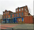
IMAGES TAKEN NEAR TO
Bollington Street, ASHTON-UNDER-LYNE, OL7 0RS

Introduction

This page details the photographs taken nearby to Bollington Street, OL7 0RS by members of the Geograph project.

The Geograph project started in 2005 with the aim of publishing, organising and preserving representative images for every square kilometre of Great Britain, Ireland and the Isle of Man.

There are currently over 7.5m images from over14,400 individuals and you can help contribute to the project by visiting https://www.geograph.org.uk

Image Map


Images are licensed for reuse under creativecommons.org/licenses/by-sa/2.0
Notes
  • Clicking on the map will re-center to the selected point.
  • The higher the marker number, the further away the image location is from the centre of the postcode.

Image Listing (208 Images Found)

Images are licensed for reuse under creativecommons.org/licenses/by-sa/2.0
  • ...
Image
Details
Distance
1
Stockport Road
The A6017 out of Ashton under Lyne.
Image: © Gerald England Taken: 13 Jun 2015
0.03 miles
2
The Trafalgar
Public house at the corner of Williams Street and Victoria Street. Originally a beerhouse owned by Nicholas N Lingard in 1868. A wine licence and a billiards licence were granted in 1899. It became a Bents & Gartside's house in 1939 until Bass took over in 1967.
Image: © Gerald England Taken: 8 May 2012
0.03 miles
3
J T Griffiths & Co Ltd
Mattress Tickings - Established 1912 according to the signage on this distressed building on Stockport Road.
Image: © Gerald England Taken: 12 Feb 2019
0.04 miles
4
The Trafalgar
Community pub at the corner of William Street and Victoria Street in Ashton-Under-Lyne. This area of Ashton dates from the early years of Queen Victoria's reign, around 170 years ago. The narrow streets were lined mostly with small terraced houses which were demolished during a slum clearance programme during the late 1950s and early 1960s and have since been replaced by modern houses with gardens. The Trafalgar Inn is now the only building in the immediate area that dates back to Victorian times.
Image: © David Dixon Taken: 28 May 2014
0.05 miles
5
Ashton-under-Lyne, The Trafalgar Inn
This area of Ashton dates from the early years of Queen Victoria's reign, around 170 years ago. The narrow streets were lined mostly with small terraced houses which were demolished during a slum clearance programme during the late 1950s and early 1960s and have since been replaced by modern houses with gardens. The Trafalgar Inn, a community pub, is the only remaining building in the immediate area that dates back to Victorian times.
Image: © David Dixon Taken: 28 May 2014
0.05 miles
6
Williams Freehouse
One of many dead pubs. The houses on the right are on Ryecroft Street.
Image: © Gerald England Taken: 30 Dec 2014
0.08 miles
7
Ali & Sons
The former Williams Freehouse Image is now Ali & Sons purveyors of Halal Meat & Groceries.
Image: © Gerald England Taken: 23 Jun 2017
0.08 miles
8
Williams Freehouse
A dead pub on William Street.
Image: © Gerald England Taken: 24 Feb 2012
0.08 miles
9
Footpath off Stockport Road
Footpath leading between two high rise blocks off Stockport Road. In the background is Junction Mill Chimney.
Image: © Gerald England Taken: 30 Dec 2014
0.11 miles
10
Ashton West End Mural
A mosaic mural on the side of a building off Stockport Road Image
Image: © Gerald England Taken: 23 Jun 2017
0.11 miles
  • ...