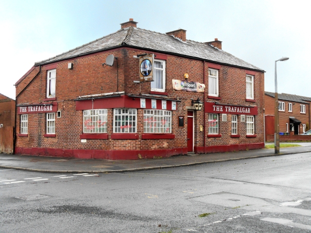
The Trafalgar
Introduction
The photograph on this page of The Trafalgar by David Dixon as part of the Geograph project.
The Geograph project started in 2005 with the aim of publishing, organising and preserving representative images for every square kilometre of Great Britain, Ireland and the Isle of Man.
There are currently over 7.5m images from over 14,400 individuals and you can help contribute to the project by visiting https://www.geograph.org.uk

Image: © David Dixon Taken: 28 May 2014
Community pub at the corner of William Street and Victoria Street in Ashton-Under-Lyne. This area of Ashton dates from the early years of Queen Victoria's reign, around 170 years ago. The narrow streets were lined mostly with small terraced houses which were demolished during a slum clearance programme during the late 1950s and early 1960s and have since been replaced by modern houses with gardens. The Trafalgar Inn is now the only building in the immediate area that dates back to Victorian times.

