
IMAGES TAKEN NEAR TO
William Street, ASHTON-UNDER-LYNE, OL7 0BH
Introduction
This page details the photographs taken nearby to William Street, OL7 0BH by members of the Geograph project.
The Geograph project started in 2005 with the aim of publishing, organising and preserving representative images for every square kilometre of Great Britain, Ireland and the Isle of Man.

There are currently over 7.5m images from over14,400 individuals and you can help contribute to the project by visiting https://www.geograph.org.uk
Image Map
Images are licensed for reuse under creativecommons.org/licenses/by-sa/2.0
Notes
- Clicking on the map will re-center to the selected point.
- The higher the marker number, the further away the image location is from the centre of the postcode.
Image Listing (137 Images Found)
Images are licensed for reuse under creativecommons.org/licenses/by-sa/2.0
Image
Details
Distance
1
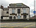
Williams Freehouse
A dead pub on William Street.
Image: © Gerald England
Taken: 24 Feb 2012
0.03 miles
2
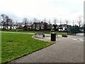
West End Park
Looking past a seating area with benches to the football pitch and William Street. To the right is the tennis court.
Image: © Gerald England
Taken: 24 Feb 2012
0.03 miles
3
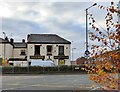
Williams Freehouse
One of many dead pubs. The houses on the right are on Ryecroft Street.
Image: © Gerald England
Taken: 30 Dec 2014
0.03 miles
4
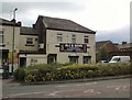
Ali & Sons
The former Williams Freehouse Image is now Ali & Sons purveyors of Halal Meat & Groceries.
Image: © Gerald England
Taken: 23 Jun 2017
0.03 miles
5
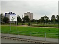
West End Park
Parkland at the Western end of Ashton-under-Lyne.
Image: © Gerald England
Taken: 23 Jul 2008
0.05 miles
6

West End Park
In the background is St Peter's Church.
Image: © Gerald England
Taken: 23 Jun 2017
0.06 miles
7
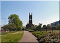
West End Park
Image: © Gerald England
Taken: 28 May 2012
0.07 miles
8

Manchester Road
The A635 inbound from Manchester to Ashton under Lyne from outside the Police HQ. Outbound traffic must follow the one way system via Stockport Road and William Street emerging in front of the Costcutters Filling Station. In the background is the tower of Tudno Mill Image
Image: © Gerald England
Taken: 27 Feb 2016
0.07 miles
9
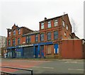
J T Griffiths & Co Ltd
Mattress Tickings - Established 1912 according to the signage on this distressed building on Stockport Road.
Image: © Gerald England
Taken: 12 Feb 2019
0.07 miles
10
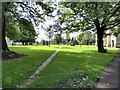
St Peter's churchyard
The churchyard at St Peter's has been largely cleared of graves but a few isolated tombs remain.
Image: © Gerald England
Taken: 8 Sep 2017
0.08 miles