IMAGES TAKEN NEAR TO
Brecon Crescent, ASHTON-UNDER-LYNE, OL6 8XP
Introduction
This page details the photographs taken nearby to Brecon Crescent, OL6 8XP by members of the Geograph project.
The Geograph project started in 2005 with the aim of publishing, organising and preserving representative images for every square kilometre of Great Britain, Ireland and the Isle of Man.

There are currently over 7.5m images from over14,400 individuals and you can help contribute to the project by visiting https://www.geograph.org.uk
Image Map
Images are licensed for reuse under creativecommons.org/licenses/by-sa/2.0
Notes
- Clicking on the map will re-center to the selected point.
- The higher the marker number, the further away the image location is from the centre of the postcode.
Image Listing (9 Images Found)
Images are licensed for reuse under creativecommons.org/licenses/by-sa/2.0
Image
Details
Distance
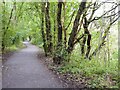
1
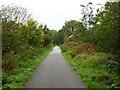
Cycle path following route of former railway
On the embankment across Downshaw Clough. The railway connected Ashton-under-Lyne and Oldham.
Image: © Kevin Waterhouse
Taken: 2 Oct 2023
0.09 miles
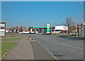
2
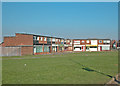
Alt Road Shops
Built to serve a large post war housing development.
Image: © Dennis Turner
Taken: 17 Feb 2003
0.14 miles
5
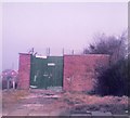
Gambrel Bank Road
Electricity sub station on Gambrel Bank Road.
Image: © Gerald England
Taken: Unknown
0.14 miles
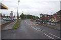
6
Alt Road
Road leading to and passing through a large post war (WW2) housing development.
Image: © Dennis Turner
Taken: 17 Feb 2003
0.20 miles
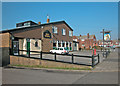
7
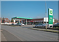
Alt Road services
Local petrol station, vehicle repair workshop, Spar grocery and car sales.
Image: © Dennis Turner
Taken: 17 Feb 2003
0.20 miles
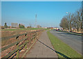
8
St Albans Avenue
An important road north of Broadoak to access much of the newer housing development. Ashton rugby club is just beyond the garage on the left.
Image: © Bill Boaden
Taken: 29 May 2010
0.21 miles
9
Cycle path following route of former railway
On the embankment across Holden Clough. The railway connected Ashton-under-Lyne with Oldham.
Image: © Kevin Waterhouse
Taken: 2 Oct 2023
0.25 miles