
IMAGES TAKEN NEAR TO
Margaret Street, ASHTON-UNDER-LYNE, OL6 7BQ
Introduction
This page details the photographs taken nearby to Margaret Street, OL6 7BQ by members of the Geograph project.
The Geograph project started in 2005 with the aim of publishing, organising and preserving representative images for every square kilometre of Great Britain, Ireland and the Isle of Man.

There are currently over 7.5m images from over14,400 individuals and you can help contribute to the project by visiting https://www.geograph.org.uk
Image Map
Images are licensed for reuse under creativecommons.org/licenses/by-sa/2.0
Notes
- Clicking on the map will re-center to the selected point.
- The higher the marker number, the further away the image location is from the centre of the postcode.
Image Listing (229 Images Found)
Images are licensed for reuse under creativecommons.org/licenses/by-sa/2.0
Image
Details
Distance
1
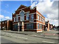
Corner of Richmond Street and Dean Street
The premises on the corner seems to have been vacant for a number of years.
Image: © Gerald England
Taken: 23 Apr 2017
0.06 miles
2
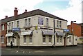
Welbeck Hotel
Welbeck Hotel on Katherine Street.
Image: © Gerald England
Taken: 19 Jun 2012
0.07 miles
3
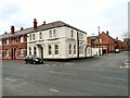
Welbeck House
The former Welbeck House Hotel Image on Katherine Street has been converted into (presumably) apartments.
Image: © Gerald England
Taken: 2 Apr 2013
0.07 miles
4
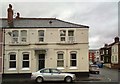
Corner of Katherine Street and Welbeck Street North
The house on the corner was formerly the Welbeck Hotel Image
Image: © Gerald England
Taken: 5 Feb 2014
0.07 miles
5
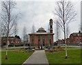
Richmond Hill Mosque
In the middle of the one-way system that is Richmond Street and Margaret Street and there is a small open space with benches around some standing stones.
Behind it on Richmond Street is The Masjid Hamza Mosque, also known as the Madrassa Arabia Taleemul Qur'an and Mosque, which has space for 1,300 male worshippers.
Katherine Street on the right is named after the wife of George Henry Grey, the Seventh Earl of Stamford. His wife, whom George married on the 29 August 1855, was a circus bareback rider. https://mancunian1001.wordpress.com/2013/02/14/down-our-street-6-katherine-street-and-penny-meadow-ashton-under-lyne/
Image: © Gerald England
Taken: 27 Feb 2016
0.08 miles
6
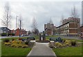
Richmond Park
In the middle of the one-way system that is Margaret Street and Richmond Street there is a small open space with benches around some standing stones.
The estate on the right is Richmond Park. The tower blocks and maisonettes were built in 1965, using the BISON prefabricated building system. Along with the West End estate, they are owned by Ashton Pioneer Homes http://www.ashtonpioneerhomes.co.uk/ an arms length management organisation formed in 1999, that took over operations hitherto carried out by Tameside MBC's housing department.
Katherine Street on the left is named after the wife of George Henry Grey, the Seventh Earl of Stamford. His wife, whom George married on the 29 August 1855, was a circus bareback rider. https://mancunian1001.wordpress.com/2013/02/14/down-our-street-6-katherine-street-and-penny-meadow-ashton-under-lyne/
Image: © Gerald England
Taken: 27 Feb 2016
0.08 miles
7
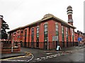
Madrassa Arabia Mosque, Ashton-Under-Lyne
Image: © Roger Cornfoot
Taken: 28 Jul 2017
0.09 miles
8
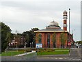
Madrassa Arabia Mosque
At the corner of Katherine Street and Richmond Street.
Image: © Gerald England
Taken: 6 Sep 2010
0.09 miles
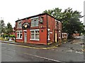
10
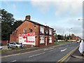
Margaret Street
The Ring o Bells Image on the corner of Moss Street and Margaret Street. Once surrounded by terraced house, by the 1980s it was surrounded by light industry. Now Margaret Street is part of the one-way system at the West End of Ashton between Katherine Street and Chester Square. The now somewhat isolated pub was originally a beerhouse owned by James Wood from 1863 to 1882. It became a Bents and Gartside's pub in 1939 and granted a full licence in 1953. It became a Bass pub in 1967 but is now a free house.
Image: © Gerald England
Taken: 3 Sep 2012
0.10 miles