Richmond Park
Introduction
The photograph on this page of Richmond Park by Gerald England as part of the Geograph project.
The Geograph project started in 2005 with the aim of publishing, organising and preserving representative images for every square kilometre of Great Britain, Ireland and the Isle of Man.

There are currently over 7.5m images from over 14,400 individuals and you can help contribute to the project by visiting https://www.geograph.org.uk
Richmond Park
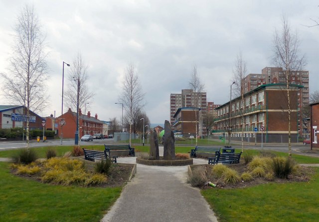
Image: © Gerald England Taken: 27 Feb 2016
In the middle of the one-way system that is Margaret Street and Richmond Street there is a small open space with benches around some standing stones. The estate on the right is Richmond Park. The tower blocks and maisonettes were built in 1965, using the BISON prefabricated building system. Along with the West End estate, they are owned by Ashton Pioneer Homes http://www.ashtonpioneerhomes.co.uk/ an arms length management organisation formed in 1999, that took over operations hitherto carried out by Tameside MBC's housing department. Katherine Street on the left is named after the wife of George Henry Grey, the Seventh Earl of Stamford. His wife, whom George married on the 29 August 1855, was a circus bareback rider. https://mancunian1001.wordpress.com/2013/02/14/down-our-street-6-katherine-street-and-penny-meadow-ashton-under-lyne/
Images are licensed for reuse under creativecommons.org/licenses/by-sa/2.0
Image Location
Latitude
53.486229
Longitude
-2.105152