
IMAGES TAKEN NEAR TO
The Willows, ASHTON-UNDER-LYNE, OL5 9EN
Introduction
This page details the photographs taken nearby to The Willows, OL5 9EN by members of the Geograph project.
The Geograph project started in 2005 with the aim of publishing, organising and preserving representative images for every square kilometre of Great Britain, Ireland and the Isle of Man.

There are currently over 7.5m images from over14,400 individuals and you can help contribute to the project by visiting https://www.geograph.org.uk
Image Map
Images are licensed for reuse under creativecommons.org/licenses/by-sa/2.0
Notes
- Clicking on the map will re-center to the selected point.
- The higher the marker number, the further away the image location is from the centre of the postcode.
Image Listing (23 Images Found)
Images are licensed for reuse under creativecommons.org/licenses/by-sa/2.0
Image
Details
Distance
1
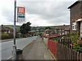
Winterford Road
Looking down towards Mossley.
Image: © Gerald England
Taken: 12 Aug 2009
0.04 miles
2
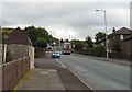
Winterford Road
Looking up towards Mossley Hollins School.
Image: © Gerald England
Taken: 12 Aug 2009
0.05 miles
4
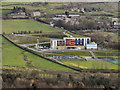
Mossley Hollins School
The new buildings of Mossley Hollins School, off Huddersfield Road, were opened in March 2011 http://www.mossleyhollins.com/index.php?option=com_content&task=view&id=145&Itemid=214 (school web site) http://menmedia.co.uk/tamesideadvertiser/news/s/1410127_glimpse_of_the_future_at_new_mossley_hollins_school (Tameside Advertiser).
The school was rebuilt as part of the previous government's "Building Schools for the Future" investment.
This view is looking across the Tame Valley, from Quick Edge.
Image: © David Dixon
Taken: 12 Dec 2011
0.10 miles
5
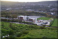
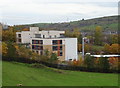
The new academy at Mossley
This will replace Mossley Hollins High School.
Image: © Bill Boaden
Taken: 27 Oct 2010
0.10 miles
7
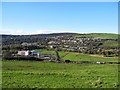
New Mossley Hollins High School
View west from More Edge Road (Tameside Trail). Hartshead Pike (SD9602) on the skyline.
Image: © John Topping
Taken: 4 Nov 2013
0.12 miles

9
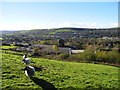
Water Works, Mossley
View southwest from Moor Edge Road.
Image: © John Topping
Taken: 4 Nov 2013
0.16 miles
10
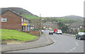
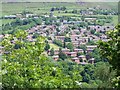
Mansfield Road, Micklehurst, Mossley
Looking along Mansfield Road, on Hollins Estate, in Micklehurst, Mossley. Buckton Castle ancient hill fort is on the skyline to the left.
Image: © Martin Clark
Taken: Unknown
0.17 miles