
IMAGES TAKEN NEAR TO
George Street, ASHTON-UNDER-LYNE, OL5 0JF
Introduction
This page details the photographs taken nearby to George Street, OL5 0JF by members of the Geograph project.
The Geograph project started in 2005 with the aim of publishing, organising and preserving representative images for every square kilometre of Great Britain, Ireland and the Isle of Man.

There are currently over 7.5m images from over14,400 individuals and you can help contribute to the project by visiting https://www.geograph.org.uk
Image Map
Images are licensed for reuse under creativecommons.org/licenses/by-sa/2.0
Notes
- Clicking on the map will re-center to the selected point.
- The higher the marker number, the further away the image location is from the centre of the postcode.
Image Listing (106 Images Found)
Images are licensed for reuse under creativecommons.org/licenses/by-sa/2.0
Image
Details
Distance
1
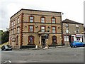
Giorgio's
Originally the George Hotel opened in 1826. It recently reopened as cafe-bar.
Image: © Gerald England
Taken: 12 Aug 2009
0.01 miles
2

The Blazing Rag
On George Street in Top Mossley. It opened in 1856 as a beerhouse called "The Welcome Return".
It did not become fully licensed until 1960. In 1986 the pub was renamed "The Blazing Rag", although that had in fact been its nickname for many years. The pub had been popular with followers of the sport of dog trailing, in which a rag soaked in aniseed was dragged along the ground creating a trail for the dogs to follow, as dogs are particularly keen on the scent. When the hunt was over it was the practice to throw the rag onto the fire in the bar, giving rise to the nickname "The Blazing Rag", or just "The Rag". The pub is one of the locations for the performance of the Mossley Pace Egg Play every Easter Monday.
http://ashton-under-lyne.blogspot.com/2009/08/mossley-on-monday-blazing-rag.html
Image
Image: © Gerald England
Taken: 12 Aug 2009
0.02 miles
3

Sign of the Blazing Rag
Sign for the Blazing Rag Image
Image: © Gerald England
Taken: 12 Aug 2009
0.02 miles
5
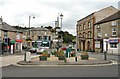
Top Mossley
There is a confusing amount of signs and street furniture at this major junction in Top Mossley. The through route from left to right is the A670 from Ashton to Uppermill. Traffic in the opposite direction veers left (photographer's right) into Stamford Street as a one-way system operates. The road to the left at the lights leads to Lees and a right turn at the lights leads to Bottom Mossley.
Image: © Gerald England
Taken: 12 Aug 2009
0.03 miles
7
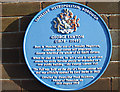
George Lawton's blue plaque
Affixed to the wall of the George Lawton Hall, Stamford Street, Top Mossley.
Image: © michael ely
Taken: 20 Jan 2009
0.03 miles
8
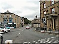
Stockport Road, Mossley
The A670 from Ashton under Lyne to Uppermill.
Image: © Gerald England
Taken: 12 Aug 2009
0.03 miles
9
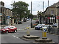
Top Mossley
Looking south from the end of Lees Road.
Image: © michael ely
Taken: 23 Aug 2008
0.03 miles
10
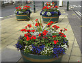
Floral display
A colourful display of geraniums and lobelia in planters on Stamford Street, Top Mossley.
Image: © michael ely
Taken: 23 Aug 2008
0.03 miles