Top Mossley
Introduction
The photograph on this page of Top Mossley by Gerald England as part of the Geograph project.
The Geograph project started in 2005 with the aim of publishing, organising and preserving representative images for every square kilometre of Great Britain, Ireland and the Isle of Man.

There are currently over 7.5m images from over 14,400 individuals and you can help contribute to the project by visiting https://www.geograph.org.uk
Top Mossley
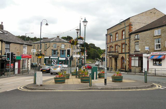
Image: © Gerald England Taken: 12 Aug 2009
There is a confusing amount of signs and street furniture at this major junction in Top Mossley. The through route from left to right is the A670 from Ashton to Uppermill. Traffic in the opposite direction veers left (photographer's right) into Stamford Street as a one-way system operates. The road to the left at the lights leads to Lees and a right turn at the lights leads to Bottom Mossley.
Images are licensed for reuse under creativecommons.org/licenses/by-sa/2.0
Image Location
Latitude
53.519254
Longitude
-2.046263