IMAGES TAKEN NEAR TO
Fairway Road, OLDHAM, OL4 5QE
Introduction
This page details the photographs taken nearby to Fairway Road, OL4 5QE by members of the Geograph project.
The Geograph project started in 2005 with the aim of publishing, organising and preserving representative images for every square kilometre of Great Britain, Ireland and the Isle of Man.

There are currently over 7.5m images from over14,400 individuals and you can help contribute to the project by visiting https://www.geograph.org.uk
Image Map
Images are licensed for reuse under creativecommons.org/licenses/by-sa/2.0
Notes
- Clicking on the map will re-center to the selected point.
- The higher the marker number, the further away the image location is from the centre of the postcode.
Image Listing (10 Images Found)
Images are licensed for reuse under creativecommons.org/licenses/by-sa/2.0
Image
Details
Distance
1
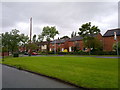
Wildmoor Avenue in Holts, Oldham
Housing on Wildmoor Avenue, in the Holts area of Oldham, Greater Manchester. Holts is occupied by Holts Estate, a purpose-built social housing area.
Image: © Steven Haslington
Taken: 30 May 2011
0.11 miles
2
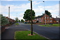
Wildmoor Avenue, Holts
Flags are still in evidence as England's final match in World Cup 2014 is being played.
Image: © Bill Boaden
Taken: 24 Jun 2014
0.11 miles
3
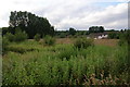
Open land at Holts
As yet undeveloped, but you feel somebody must want to put houses on it soon. The houses visible are part of a new development where there used to be a chapel marked on the map.
Image: © Bill Boaden
Taken: 24 Jun 2014
0.13 miles
4
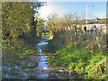
Bridle Path from County End
This pathway meanders around and about for a while, but eventually emerges by the entrance to Oldham Golf Club on Lees New Road. Lunchtime, and the overnight ice formed on the path was just starting to melt, making the going treacherous.
Image: © Roger May
Taken: 18 Nov 2005
0.18 miles
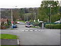
5
The Club House, Oldham Golf Club
The club house on Lees New Road, Holts.
Image: © David Dixon
Taken: 13 Oct 2011
0.18 miles
7
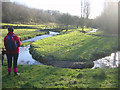
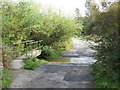
Meander in River Medlock
A meander in the River Medlock, just west of Holts, south-east of Oldham.
Image: © Martin Clark
Taken: Unknown
0.24 miles
8
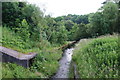
Thornley Brook
Shortly to join the River Medlock.
Image: © Bill Boaden
Taken: 24 Jun 2014
0.24 miles
10
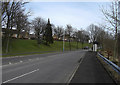
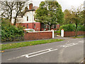
Lees New Road, Holts
The houses at left of shot are part of the Holts Estate, originally local authority housing stock. Holts is at the southeastern edge of Oldham in the Medlock Valley and next to open countryside.
Image: © michael ely
Taken: 3 Mar 2010
0.25 miles