
IMAGES TAKEN NEAR TO
Melford Grove, OLDHAM, OL4 3HH
Introduction
This page details the photographs taken nearby to Melford Grove, OL4 3HH by members of the Geograph project.
The Geograph project started in 2005 with the aim of publishing, organising and preserving representative images for every square kilometre of Great Britain, Ireland and the Isle of Man.

There are currently over 7.5m images from over14,400 individuals and you can help contribute to the project by visiting https://www.geograph.org.uk
Image Map
Images are licensed for reuse under creativecommons.org/licenses/by-sa/2.0
Notes
- Clicking on the map will re-center to the selected point.
- The higher the marker number, the further away the image location is from the centre of the postcode.
Image Listing (12 Images Found)
Images are licensed for reuse under creativecommons.org/licenses/by-sa/2.0
Image
Details
Distance
2
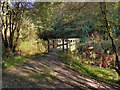
Wooden Bridge Over River medlock
The wooden bridge over the River Medlock at Leesbrook Nature Park.
Image: © David Dixon
Taken: 13 Oct 2011
0.10 miles
3

View from Greenacres Cemetery
The bottom end of Greenacres Cemetery above Constantine Street, looking towards the dismantled railway line and mills in Lees. Most of the vacant spaces are now filled with housing.
Image: © Gerald England
Taken: Unknown
0.10 miles
5
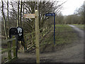
Medlock Valley Way, Bank Top
Looking west along the line of a disused railway that has now been converted to recreational use. The Medlock Valley Way heads left of shot towards Leesfield.
Image: © michael ely
Taken: 3 Mar 2010
0.11 miles
6
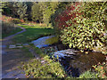
River Medlock Weir, Leesbrook
The weir on the River Medlock at Leesbrook Nature Park
Image: © David Dixon
Taken: 13 Oct 2011
0.12 miles
7
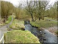
River Medlock at Lees
View on the Medlock Valley Way from a footbridge
Image: © Kevin Waterhouse
Taken: 10 Feb 2023
0.14 miles
9
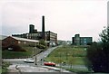
Bank Top Mill, Edmund Street, Oldham
The Bank Top Mill was built in 1875. When I took the photograph it was owned by Newroyds. The low buildings in front of the Bank Top are on the site of the Clarksfield Mill. Wellyhole Street, a former Roman road, runs up the centre of the photograph. The Windsor Mill, formerly the Egyptian Mill built about 1836, is across Wellyhole St from the Bank Top. It ended its days as a warehouse for Newroyds. Houses now stand on the sites of all three mills.
Image: © M Campbell
Taken: Unknown
0.22 miles
10
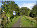
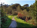
Leesbrook Nature Park
The path into Leesbrook Nature Park, from Brook Lane.
Image: © David Dixon
Taken: 13 Oct 2011
0.23 miles