
IMAGES TAKEN NEAR TO
Well-I-Hole Road, OLDHAM, OL3 7HY
Introduction
This page details the photographs taken nearby to Well-I-Hole Road, OL3 7HY by members of the Geograph project.
The Geograph project started in 2005 with the aim of publishing, organising and preserving representative images for every square kilometre of Great Britain, Ireland and the Isle of Man.

There are currently over 7.5m images from over14,400 individuals and you can help contribute to the project by visiting https://www.geograph.org.uk
Image Map
Images are licensed for reuse under creativecommons.org/licenses/by-sa/2.0
Notes
- Clicking on the map will re-center to the selected point.
- The higher the marker number, the further away the image location is from the centre of the postcode.
Image Listing (50 Images Found)
Images are licensed for reuse under creativecommons.org/licenses/by-sa/2.0
Image
Details
Distance
1
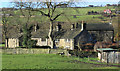
Wellihole Farm
This very old farmstead continues to operate as a dairy farm.
Image: © Michael Fox
Taken: 16 Nov 2010
0.02 miles
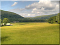
3
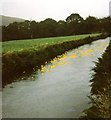
River Tame
"Duck racing" on the River Tame near Greenfield.
Image: © Gerald England
Taken: 27 Aug 1988
0.05 miles
4
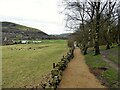
Cycle route update
The route has followed that of a former railway but at this point there was a tunnel (no longer visible). There is a busy road junction here of the A635 and B6175 so it appears a safer crossing route for cyclists and others is being prepared.
Image: © Kevin Waterhouse
Taken: 19 Mar 2023
0.11 miles
5
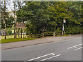
The Tame Valley, Friezland
Entrance to Tame Valley from Manchester Road.
Image: © David Dixon
Taken: 14 Jul 2012
0.11 miles
6
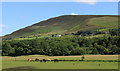
Wellihole, Geenfield
The horses are grazing alongside the River Tame as it runs in an artificial channel through fields between Manns and Wellihole Farm. Alphin Pike (1550') dominates the background.
Image: © Michael Fox
Taken: 6 Jul 2011
0.12 miles
8
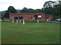
Saddleworth Cricket Club Pavilion
Saddleworth CC play in the Saddleworth & District League.
The obelisk near Aldermans Hill can be seen in the background.
Image: © BatAndBall
Taken: 7 Jul 2011
0.13 miles
9
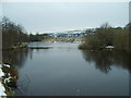
Reservoir
The buildings in the distance is Royal George Mills, being converted into housing.
Image: © Alexander P Kapp
Taken: 12 Feb 2009
0.13 miles
10
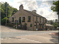
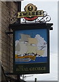
The Royal George
Large public house at the corner of Manchester Road (A635) and Huddersfield Road (B6175).
Image: © David Dixon
Taken: 14 Jul 2012
0.14 miles