
IMAGES TAKEN NEAR TO
Berry Brow, OLDHAM, OL3 7EJ
Introduction
This page details the photographs taken nearby to Berry Brow, OL3 7EJ by members of the Geograph project.
The Geograph project started in 2005 with the aim of publishing, organising and preserving representative images for every square kilometre of Great Britain, Ireland and the Isle of Man.

There are currently over 7.5m images from over14,400 individuals and you can help contribute to the project by visiting https://www.geograph.org.uk
Image Map
Images are licensed for reuse under creativecommons.org/licenses/by-sa/2.0
Notes
- Clicking on the map will re-center to the selected point.
- The higher the marker number, the further away the image location is from the centre of the postcode.
Image Listing (55 Images Found)
Images are licensed for reuse under creativecommons.org/licenses/by-sa/2.0
Image
Details
Distance
1
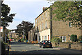
Chew Valley Road, Greenfield
The three-storey building, which dates from the late nineteenth century, was the hall of the erstwhile Greenfield Co-operative Society.
Image: © Michael Fox
Taken: 27 Sep 2011
0.06 miles
2
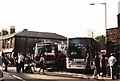
Whit Friday in Greenfield
On Whit Friday, band contests take place in several villages around Saddleworth with coaches taking the bands from one contest to another. Here in Greenfield, musicians are making their way back to the coach which will take them to their next venue.
Image: © Gerald England
Taken: Unknown
0.07 miles
3
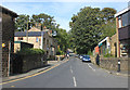
Kinders Lane, Greenfield
Viewed from Road End in the centre of the village, Kinders Lane is likely to be on the line of a very old trackway from Cheshire to the Standedge ridge above Diggle.
Image: © Michael Fox
Taken: 27 Sep 2011
0.07 miles
5
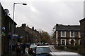
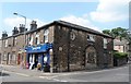
Chew Valley Road, Greenfield
Prominent is the King William IV pub, known to locals as the King Bill.
Image: © Bill Boaden
Taken: 31 Oct 2009
0.07 miles
8
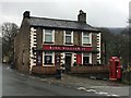
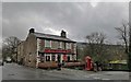
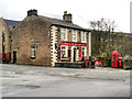
The King William IV
Public house on Chew Valley Road
Image: © Graham Hogg
Taken: 18 Mar 2019
0.07 miles
9
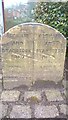
Boundary Stone, Chew Valley Road, Greenfield
Image: © Benjamin Shaw
Taken: 16 Apr 2016
0.08 miles
10
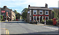
Road End, Greenfield
The name 'Road End' is thought to have arisen from Chew Valley Road having stopped here for a few years before being extended out of the picture towards the 'Clarence' later in the nineteenth century.
Image: © Michael Fox
Taken: 27 Sep 2011
0.08 miles