
IMAGES TAKEN NEAR TO
Neale Avenue, OLDHAM, OL3 7DL
Introduction
This page details the photographs taken nearby to Neale Avenue, OL3 7DL by members of the Geograph project.
The Geograph project started in 2005 with the aim of publishing, organising and preserving representative images for every square kilometre of Great Britain, Ireland and the Isle of Man.

There are currently over 7.5m images from over14,400 individuals and you can help contribute to the project by visiting https://www.geograph.org.uk
Image Map
Images are licensed for reuse under creativecommons.org/licenses/by-sa/2.0
Notes
- Clicking on the map will re-center to the selected point.
- The higher the marker number, the further away the image location is from the centre of the postcode.
Image Listing (64 Images Found)
Images are licensed for reuse under creativecommons.org/licenses/by-sa/2.0
Image
Details
Distance
2
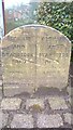
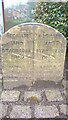
Boundary Stone, Chew Valley Road, Greenfield
Image: © Benjamin Shaw
Taken: 16 Apr 2016
0.06 miles
3
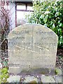
Old Boundary Marker by the A669, Chew Valley Road, Greenfield
Municipal Boundary Marker by the A669, in parish of Saddleworth (Oldham District), Chew Valley Road, Greenfield, South of junction with Grove Street, opposite No.189 on paved area with shrubs in front of office.
Surveyed
Milestone Society National ID: YW_SADD01pb
Image: © Milestone Society
Taken: Unknown
0.06 miles
4
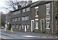
Houses on Chew Valley Road, Greenfield
The long ranges of windows suggest that those two houses might have housed home-workers, possibly in the textile trade. They date from around 1800 and are Listed Grade II.
Image: © Alan Murray-Rust
Taken: 7 Jan 2014
0.07 miles
5
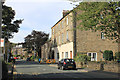
Chew Valley Road, Greenfield
The three-storey building, which dates from the late nineteenth century, was the hall of the erstwhile Greenfield Co-operative Society.
Image: © Michael Fox
Taken: 27 Sep 2011
0.07 miles
6
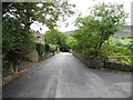
Park Lane, Greenfield
Heading down to Holmfirth Road (A635).
Image: © John Topping
Taken: 5 Oct 2013
0.11 miles
7
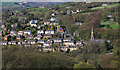
St Mary's Church and St Mary's Drive, Greenfield
Seen from Fern Lee.
Image: © Michael Fox
Taken: 8 Apr 2011
0.11 miles
9
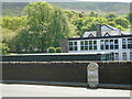
Old milestone
This shows the position of the milestone on the A669 in relation to the school buildings behind it.
Image: © Chris Minto
Taken: 21 May 2023
0.12 miles
10
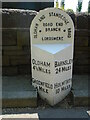
Old milestone
This milestone on Chew Valley Road near a pedestrian crossing at St Mary's CE school has been painted since 2022. Although very similar to the West Riding CC milestones this forging may be an early replacement. The style of lettering is slightly different and it doesn't have the maker's name on the bevel.
Image: © Chris Minto
Taken: 21 May 2023
0.12 miles