Old Boundary Marker by the A669, Chew Valley Road, Greenfield
Introduction
The photograph on this page of Old Boundary Marker by the A669, Chew Valley Road, Greenfield by Milestone Society as part of the Geograph project.
The Geograph project started in 2005 with the aim of publishing, organising and preserving representative images for every square kilometre of Great Britain, Ireland and the Isle of Man.

There are currently over 7.5m images from over 14,400 individuals and you can help contribute to the project by visiting https://www.geograph.org.uk
Old Boundary Marker by the A669, Chew Valley Road, Greenfield
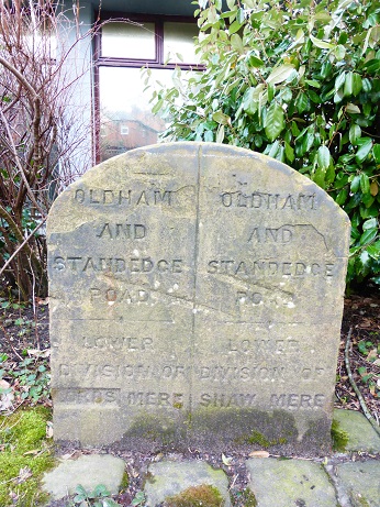
Image: © Milestone Society Taken: Unknown
Municipal Boundary Marker by the A669, in parish of Saddleworth (Oldham District), Chew Valley Road, Greenfield, South of junction with Grove Street, opposite No.189 on paved area with shrubs in front of office. Surveyed Milestone Society National ID: YW_SADD01pb
Images are licensed for reuse under creativecommons.org/licenses/by-sa/2.0
Image Location
Latitude
53.534165
Longitude
-2.002889