IMAGES TAKEN NEAR TO
Rush Hill Road, OLDHAM, OL3 6JD
Introduction
This page details the photographs taken nearby to Rush Hill Road, OL3 6JD by members of the Geograph project.
The Geograph project started in 2005 with the aim of publishing, organising and preserving representative images for every square kilometre of Great Britain, Ireland and the Isle of Man.

There are currently over 7.5m images from over14,400 individuals and you can help contribute to the project by visiting https://www.geograph.org.uk
Image Map
Images are licensed for reuse under creativecommons.org/licenses/by-sa/2.0
Notes
- Clicking on the map will re-center to the selected point.
- The higher the marker number, the further away the image location is from the centre of the postcode.
Image Listing (114 Images Found)
Images are licensed for reuse under creativecommons.org/licenses/by-sa/2.0
Image
Details
Distance
1
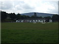
Uppermill Cricket Club Pavilion
A view of the pavilion at Uppermill CC with the summit of Alphin in the background.
Image: © BatAndBall
Taken: 10 Jul 2011
0.04 miles
3
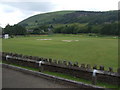
Uppermill Cricket Club
Uppermill CC play in the Saddleworth and District League.
Looking across the Lea Fields pitch towards the Wharmton mast.
Image: © BatAndBall
Taken: 10 Jul 2011
0.07 miles
4
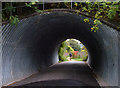
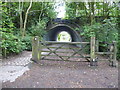
Pennine Bridleway, Uppermill
The National Trail bypasses the village of Uppermill (using the trackbed of a disused railway) so to visit its attractions one has to make a detour. Here the route passes through a tunnel under Rush Hill Road.
Image: © michael ely
Taken: 27 Sep 2007
0.08 miles
5
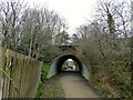
Subway under Rush Hill Road
On the route of a former railway through Uppermill now a multi-purpose route and used by the Tame Valley Way
Image: © Kevin Waterhouse
Taken: 19 Mar 2023
0.08 miles
6
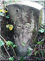
Old Boundary Marker by River Tame, Saddleworth Parish
Parish Boundary Marker in parish of Saddleworth (Oldham District), on river bank 60m North of Carr Lane bridge over river.
Surveyed
Milestone Society National ID: YW_UPM02pb
Image: © Milestone Society
Taken: Unknown
0.10 miles
7
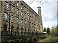
Alexandra Mill Uppermill
Built in 1860 by flannel manufactures J.Bradbury & Co this four storey stone built mill has had many uses over the years.
In the mid 1980s it was a craft centre which was divided into small units.
Today the mill on the banks of the river Tame has been converted into stylish living apartments.
For future reference a 2 bedroom fourth floor flat was on the market
for £199,950 in March 2009.
Image
Image: © Paul Anderson
Taken: 1 Mar 2009
0.12 miles
8
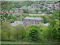
Alexandra Mill Uppermill
Built in 1860 by flannel manufactures J.Bradbury & Co this four storey stone built mill has had many uses over the years.
In the mid 1980s it was a craft centre which was divided into small units.
Today the mill on the banks of the river Tame has been converted into stylish living apartments.
For future reference a 2 bedroom fourth floor flat was on the market
for £199,950 in March 2009.
Image
Just above the rooftop of the mill you can see Uppermill Cricket Club.
Image: © Paul Anderson
Taken: 9 May 2009
0.12 miles
9

The River Tame behind Spring Mill, Uppermill
Image: © habiloid
Taken: 6 Mar 2026
0.12 miles