
IMAGES TAKEN NEAR TO
Brooke View, OLDHAM, OL3 5GF
Introduction
This page details the photographs taken nearby to Brooke View, OL3 5GF by members of the Geograph project.
The Geograph project started in 2005 with the aim of publishing, organising and preserving representative images for every square kilometre of Great Britain, Ireland and the Isle of Man.

There are currently over 7.5m images from over14,400 individuals and you can help contribute to the project by visiting https://www.geograph.org.uk
Image Map
Images are licensed for reuse under creativecommons.org/licenses/by-sa/2.0
Notes
- Clicking on the map will re-center to the selected point.
- The higher the marker number, the further away the image location is from the centre of the postcode.
Image Listing (44 Images Found)
Images are licensed for reuse under creativecommons.org/licenses/by-sa/2.0
Image
Details
Distance
1
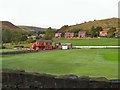
Delph and Dobcross Cricket Club
Viewed from the A62 trunk road. No match today, alas.
Image: © Roger May
Taken: 9 Oct 2005
0.02 miles
2
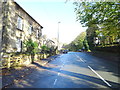
Huddersfield Road, Delph
Looking north east on the A62.
Image: © JThomas
Taken: 2 Nov 2018
0.04 miles
3
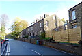
Terraced housing on Huddersfield Road, Delph
Image: © JThomas
Taken: 2 Nov 2018
0.07 miles
5
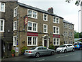
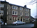
Old Bell Inn, Delph
Occupying a dignified late Georgian building. The building material is described as hammer-dressed watershot stone. Watershot stonework involves each course of stone being slightly vertically tilted so that the top projects beyond the bottom, creating a narrow ledge, in order to speed up evaporation of rainwater. I would say that it is impossible to detect from this photo. Grade II listed.
Strictly speaking it is now a hotel and restaurant rather than a pub.
Image: © Stephen Richards
Taken: 13 Jun 2016
0.12 miles
6
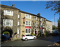
The Old Bell Inn, Delph
On Huddersfield Road.
Image: © JThomas
Taken: 2 Nov 2018
0.12 miles
7
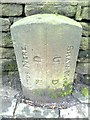
Old Boundary Marker by the A62, Huddersfield Road, Saddleworth Parish
Parish Boundary Marker by the A62, in parish of Saddleworth (Oldham District), Huddersfield Road in Delph, opposite the Old Bell Inn, against wall, by junction with Gate Head Road.
Surveyed
Milestone Society National ID: YW_HUOD13pb
Image: © D Garside
Taken: 1 Jan 2012
0.12 miles
8
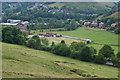
Delph & Dobcross Cricket Club
Viewed from the side of Harrop Edge. The match is between innings.
Image: © Bill Boaden
Taken: 30 Jun 2010
0.13 miles
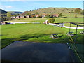
10
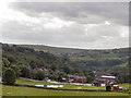
View from Huddersfield Road
Looking back, past the cricket ground towards Delph, from the A62 (Huddersfield Road)
Image: © David Dixon
Taken: 16 Jun 2011
0.13 miles