Old Boundary Marker by the A62, Huddersfield Road, Saddleworth Parish
Introduction
The photograph on this page of Old Boundary Marker by the A62, Huddersfield Road, Saddleworth Parish by D Garside as part of the Geograph project.
The Geograph project started in 2005 with the aim of publishing, organising and preserving representative images for every square kilometre of Great Britain, Ireland and the Isle of Man.

There are currently over 7.5m images from over 14,400 individuals and you can help contribute to the project by visiting https://www.geograph.org.uk
Old Boundary Marker by the A62, Huddersfield Road, Saddleworth Parish
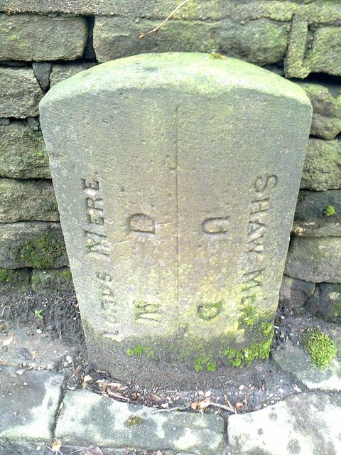
Image: © D Garside Taken: 1 Jan 2012
Parish Boundary Marker by the A62, in parish of Saddleworth (Oldham District), Huddersfield Road in Delph, opposite the Old Bell Inn, against wall, by junction with Gate Head Road. Surveyed Milestone Society National ID: YW_HUOD13pb
Images are licensed for reuse under creativecommons.org/licenses/by-sa/2.0
Image Location
Latitude
53.56414
Longitude
-2.019348