
IMAGES TAKEN NEAR TO
Harewood Road, OLDHAM, OL2 8EA
Introduction
This page details the photographs taken nearby to Harewood Road, OL2 8EA by members of the Geograph project.
The Geograph project started in 2005 with the aim of publishing, organising and preserving representative images for every square kilometre of Great Britain, Ireland and the Isle of Man.

There are currently over 7.5m images from over14,400 individuals and you can help contribute to the project by visiting https://www.geograph.org.uk
Image Map
Images are licensed for reuse under creativecommons.org/licenses/by-sa/2.0
Notes
- Clicking on the map will re-center to the selected point.
- The higher the marker number, the further away the image location is from the centre of the postcode.
Image Listing (34 Images Found)
Images are licensed for reuse under creativecommons.org/licenses/by-sa/2.0
Image
Details
Distance
1
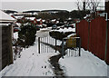
Cul-de-sac junction
This pedestrian access is between Arley Drive and Underwood Way, two cul-de-sacs. Looking towards Underwood Way.
Image: © michael ely
Taken: 3 Dec 2010
0.06 miles
2

Delamere Avenue
A cul-de-sac of detached houses opposite Buckstones primary school.
Image: © michael ely
Taken: 25 Sep 2020
0.12 miles
3
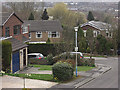
Delamere Avenue, Shaw
A small cul-de-sac of 3 and 4 bedroom detached houses near Crompton Buckstones Primary School.
Image: © michael ely
Taken: 31 Mar 2009
0.12 miles
4
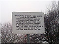
Greater Manchester Act 1981
Sign outlining the requirements of Section 163 of the Greater Manchester Act 1981, located in Shaw and Crompton, England.
I'm not sure why they needed to use the quotation marks.
Image: © Steven Haslington
Taken: 12 Jan 2011
0.14 miles
5
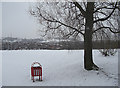
George Street playing fields, Shaw
There's not much play today during the Big Freeze of 2010. This large recreational area is situated between Milnrow Road and George Street.
Image: © michael ely
Taken: 13 Jan 2010
0.15 miles
6
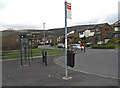
Hillside Avenue, Shaw
Looking from the bus terminus near Crompton Buckstones Primary School.
Image: © michael ely
Taken: 31 Mar 2009
0.15 miles
7
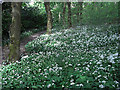
Crompton Hall Wood
The footpath, seen left of shot, links Underwood Way with Buckstones Road. The wild garlic is in bloom on the woodland floor.
Image: © michael ely
Taken: 7 May 2009
0.16 miles
8
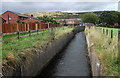
Old Brook, Shaw
Looking upstream from the northern edge of George Street playing fields. This stream rises on Crompton Moor (seen in distance) and joins the River Beal only a few metres downstream from where this photo is taken.
Image: © michael ely
Taken: 14 Sep 2011
0.16 miles
9
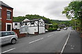
Buckstones Road
A useful road to the top of the first Pennine ridge at Grains Bar. It has a bit of climbing to do yet.
Image: © Bill Boaden
Taken: 17 Jun 2015
0.17 miles
10

The Park Inn, Crompton Fold
There is a glimpse of Jordan Brow rising up behind.
Image: © Bill Boaden
Taken: 17 Jun 2015
0.17 miles