IMAGES TAKEN NEAR TO
Goats, OLDHAM, OL2 8BH
Introduction
This page details the photographs taken nearby to Goats, OL2 8BH by members of the Geograph project.
The Geograph project started in 2005 with the aim of publishing, organising and preserving representative images for every square kilometre of Great Britain, Ireland and the Isle of Man.

There are currently over 7.5m images from over14,400 individuals and you can help contribute to the project by visiting https://www.geograph.org.uk
Image Map
Images are licensed for reuse under creativecommons.org/licenses/by-sa/2.0
Notes
- Clicking on the map will re-center to the selected point.
- The higher the marker number, the further away the image location is from the centre of the postcode.
Image Listing (60 Images Found)
Images are licensed for reuse under creativecommons.org/licenses/by-sa/2.0
Image
Details
Distance
3
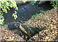
Pencil Brook meets the River Beal
The confluence is at the southern end of the estate at Dunwood Park Courts between the railway (Metrolink) line and Milnrow Road. The source of Pencil Brook can be seen here http://www.geograph.org.uk/photo/2593092 It is approximately 1.9 kms long and has a fall of some 70 metres.
Image: © michael ely
Taken: 22 Oct 2011
0.09 miles
5
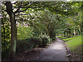
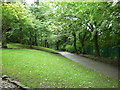
Dunwood Park, Shaw
Looking south along the main footpath through the park about 100 metres north of the tennis courts. The path runs parallel with the railway and the River Beal.
Image: © michael ely
Taken: 20 Sep 2007
0.12 miles
6
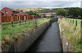
Old Brook, Shaw
Looking upstream from the northern edge of George Street playing fields. This stream rises on Crompton Moor (seen in distance) and joins the River Beal only a few metres downstream from where this photo is taken.
Image: © michael ely
Taken: 14 Sep 2011
0.12 miles
7
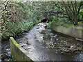
Old Brook's confluence with River Beal
This is at the northwest corner of George Street playing fields, Shaw. Old Brook is captured between the concrete culvert walls in the foreground. The River Beal is seen flowing under Milnrow Road at Goats.
Image: © michael ely
Taken: 14 Sep 2011
0.13 miles
8
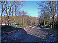
Metrolink works, Wood End
The railway lines have been removed and will be replaced with new tracks suitable for the trams.
Image: © michael ely
Taken: 28 Nov 2010
0.14 miles
9
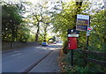
Milnrow Road (A663)
Looking south showing position of Postbox No. OL2 220.
See Image] for postbox.
Image: © JThomas
Taken: 18 Oct 2018
0.14 miles