IMAGES TAKEN NEAR TO
Lowood Close, ROCHDALE, OL16 3XG
Introduction
This page details the photographs taken nearby to Lowood Close, OL16 3XG by members of the Geograph project.
The Geograph project started in 2005 with the aim of publishing, organising and preserving representative images for every square kilometre of Great Britain, Ireland and the Isle of Man.

There are currently over 7.5m images from over14,400 individuals and you can help contribute to the project by visiting https://www.geograph.org.uk
Image Map
Images are licensed for reuse under creativecommons.org/licenses/by-sa/2.0
Notes
- Clicking on the map will re-center to the selected point.
- The higher the marker number, the further away the image location is from the centre of the postcode.
Image Listing (107 Images Found)
Images are licensed for reuse under creativecommons.org/licenses/by-sa/2.0
Image
Details
Distance
1
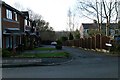
Lowood Close
A small development built on a residual portion of land left over from the construction of the housing estate on the site of Ashes farm.
Image: © Bryan Tenny
Taken: 16 Feb 2011
0.01 miles
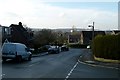
3
Silver Hill towards Kiln Lane
Part of a 1970s housing estate built on the site of Ashes farm Milnrow.
Image: © Bryan Tenny
Taken: 16 Feb 2011
0.03 miles
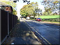
5
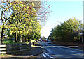
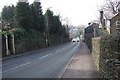
Kiln Lane, Milnrow
Looking north east on the B6225.
Image: © JThomas
Taken: 18 Oct 2018
0.04 miles
6
Silver Hill towards Ashes
Part of a 1970s housing estate built on the site of Ashes farm Milnrow.
Image: © Bryan Tenny
Taken: 16 Feb 2011
0.06 miles
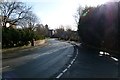
7
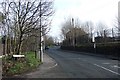
Kiln Lane towards Wildhouse Lane
The road from Milnrow to Hollingworth Lake taken from Ashes Lane. Picture taken looking up the hill towards Wildhouse Lane.
Image: © Bryan Tenny
Taken: 17 Feb 2011
0.06 miles
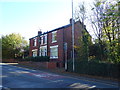
8
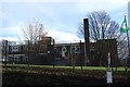
Milnrow Parish C of E Primary
Milnrow Parish Church of England Primary school (St James) viewed from Kiln Lane.
Image: © Bryan Tenny
Taken: 14 Feb 2011
0.06 miles
9
Kiln Lane towards Bridge Street
The road from Milnrow towards Hollingworth Lake.
Image: © Bryan Tenny
Taken: 16 Feb 2011
0.07 miles
10
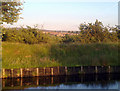
Milnrow from the Rochdale Canal
A view of Milnrow's town centre, from its outskirts by the Rochdale Canal, in Greater Manchester, England.
At this location, the canal is the conventional boundary between Belfield (in Rochdale) and Clegg/Firgrove (in Milnrow).
Rising above the suburban housing in the centre of the photograph is Milnrow's parish church, dedicated to St James the Apostle. Behind the rooftops are the foothills of the South Pennines.
Image: © Steven Haslington
Taken: 24 Jun 2010
0.08 miles