
IMAGES TAKEN NEAR TO
Brick Mill Close, ROCHDALE, OL16 3FR
Introduction
This page details the photographs taken nearby to Brick Mill Close, OL16 3FR by members of the Geograph project.
The Geograph project started in 2005 with the aim of publishing, organising and preserving representative images for every square kilometre of Great Britain, Ireland and the Isle of Man.

There are currently over 7.5m images from over14,400 individuals and you can help contribute to the project by visiting https://www.geograph.org.uk
Image Map
Images are licensed for reuse under creativecommons.org/licenses/by-sa/2.0
Notes
- Clicking on the map will re-center to the selected point.
- The higher the marker number, the further away the image location is from the centre of the postcode.
Image Listing (100 Images Found)
Images are licensed for reuse under creativecommons.org/licenses/by-sa/2.0
Image
Details
Distance
1
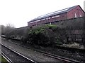
Lancashire and Yorkshire Railway Cotton Warehouse
An almost forgotten railway and an all but defunct industry.
The warehouse building lies behind the abandoned northbound (Rochdale) platform at Newhey station on the Oldham - Rochdale railway.
Image: © Peter Thwaite
Taken: 25 Dec 2008
0.03 miles
2
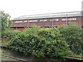
L&Y Cotton Warehouse, New Hey
The large size of this warehouse gives an idea of the large volume of cotton traffic handled here. The warehouse has been out of railway use for many years, but it is good to see the original name picked out in white and still kept clean.
Image: © Dr Neil Clifton
Taken: 18 Sep 2009
0.04 miles
3
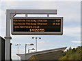
Metrolink Information Sign, Newhey Station
Image: © David Dixon
Taken: 6 Oct 2013
0.04 miles
5
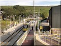
Newhey Tram Station
Metrolink Bombardier M500o tram number 3009 stands at Newhey station, on its journey towards Rochdale.
Newhey Railway Station was opened in 1863 by the Lancashire & Yorkshire Railway (later taken over by the London & North Western and then London Midland and Scottish Railways in 1922 and 1923 respectively). The station was closed in 2009 in preparation for the new Metrolink Tramway. Most of the old station was demolished and has since been replaced by the shiny new Metrolink stop/station seen here.
The stop has two side platforms to the south–east of Huddersfield Road from where this photograph is taken. The outbound (Rochdale) platform ramped path has a folded back route, with some steps shortening it.
Image: © David Dixon
Taken: 6 Oct 2013
0.05 miles
6
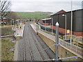
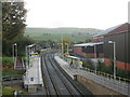
New Hey railway / Metrolink station, Greater Manchester
Opened in 1863 on the Lancashire & Yorkshire Railway's "Oldham Loop" line from Manchester to Rochdale, this station closed to 'heavy' rail traffic in 2009. It was rebuilt and reopened in 2013 as part of Metrolink.
View south east towards Shaw & Crompton and Manchester
Image: © Nigel Thompson
Taken: 30 Dec 2013
0.05 miles
7
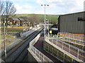
Newhey: Metrolink station
Compare with my image taken some 47 years previously at Image
Image: © Dr Neil Clifton
Taken: 27 Feb 2015
0.05 miles

9
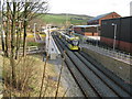
Newhey Metrolink station
A 'double unit' tram at Newhey, bound for Rochdale. It has come from East Didsbury, via Central Manchester
Image: © Dr Neil Clifton
Taken: 27 Feb 2015
0.05 miles
10
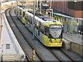
Newhey: Metrolink station
Car No 3070 heads a 'double unit' tram on its way to Rochdale.
Image: © Dr Neil Clifton
Taken: 27 Feb 2015
0.05 miles