
IMAGES TAKEN NEAR TO
Sandringham Drive, ROCHDALE, OL16 3EJ
Introduction
This page details the photographs taken nearby to Sandringham Drive, OL16 3EJ by members of the Geograph project.
The Geograph project started in 2005 with the aim of publishing, organising and preserving representative images for every square kilometre of Great Britain, Ireland and the Isle of Man.

There are currently over 7.5m images from over14,400 individuals and you can help contribute to the project by visiting https://www.geograph.org.uk
Image Map
Images are licensed for reuse under creativecommons.org/licenses/by-sa/2.0
Notes
- Clicking on the map will re-center to the selected point.
- The higher the marker number, the further away the image location is from the centre of the postcode.
Image Listing (71 Images Found)
Images are licensed for reuse under creativecommons.org/licenses/by-sa/2.0
Image
Details
Distance
1
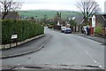
Sandringham Drive
Part of a 1960s housing estate. This builder either named his roads after rivers or gave them a 'Royal' connection.
Image: © Bryan Tenny
Taken: 5 Apr 2011
0.01 miles
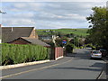
3
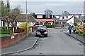
Balmoral Close
Part of a 1970s housing estate. The builder either used the names of rivers or gave his roads 'Royal' connections.
Image: © Bryan Tenny
Taken: 5 Apr 2011
0.03 miles
4
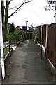
Hillside View
Part of a 1970s housing estate, this picture was taken from its junction with Sandringham Drive.
Image: © Bryan Tenny
Taken: 5 Apr 2011
0.05 miles
5
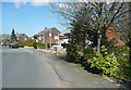
Public footpath off Pennine Drive, Milnrow
A suburban path not shown on the OS map but signposted as public.
Image: © Humphrey Bolton
Taken: 11 Apr 2019
0.06 miles
7
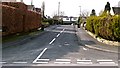
Kensington Close
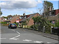
Another 1960s housing estate built on the site of Lowhouse farm. This builder named his streets after rivers or palaces. The other builder named his after mountain ranges, this caused some confusion in the Rochdale area as he built more than one estate with the same street names. This was allowed because they were in different local authorities prior to the 1974 re-organisation of local government.
Image: © Bryan Tenny
Taken: 4 Mar 2011
0.08 miles
8
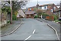
Smith Hill
Part of a 1960s housing estate. This road is a continuation of a 1920/30s estate road.
Image: © Bryan Tenny
Taken: 5 Apr 2011
0.09 miles
9
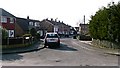
Cheviot Close
Part of a 1960s housing estate built on the site of Lowhouse farm.
Image: © Bryan Tenny
Taken: 4 Mar 2011
0.11 miles
10
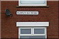
Hurstead Road sign
A street sign at one end of Hurstead Road. Compare with the Hursted Road sign at the other end.
Image: © Bryan Tenny
Taken: 19 Apr 2011
0.12 miles