IMAGES TAKEN NEAR TO
Woods Passage, LITTLEBOROUGH, OL15 8LZ
Introduction
This page details the photographs taken nearby to Woods Passage, OL15 8LZ by members of the Geograph project.
The Geograph project started in 2005 with the aim of publishing, organising and preserving representative images for every square kilometre of Great Britain, Ireland and the Isle of Man.

There are currently over 7.5m images from over14,400 individuals and you can help contribute to the project by visiting https://www.geograph.org.uk
Image Map
Images are licensed for reuse under creativecommons.org/licenses/by-sa/2.0
Notes
- Clicking on the map will re-center to the selected point.
- The higher the marker number, the further away the image location is from the centre of the postcode.
Image Listing (25 Images Found)
Images are licensed for reuse under creativecommons.org/licenses/by-sa/2.0
Image
Details
Distance
4
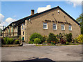
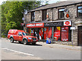
Kingdom Hall of Jehovah's Witnesses
School Street, Dearnley
Image: © David Dixon
Taken: 18 May 2010
0.07 miles
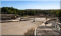
5
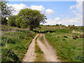
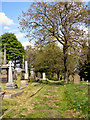
Track towards Starring
From the side of the Kingdom Hall at Dearnley.
Image: © David Dixon
Taken: 18 May 2010
0.10 miles
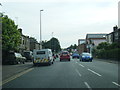
6
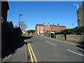
Starring Way
Looking north from Featherstall Road.
Image: © JThomas
Taken: 18 Oct 2018
0.12 miles
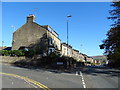
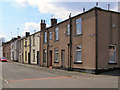
9
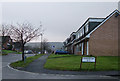
Private Housing, Littleborough.
An estate of semi-detached dormer bungalows built in the late 1960s/early 1970s on farmland near Littleborough.
Image: © michael ely
Taken: 10 Dec 2005
0.13 miles