
IMAGES TAKEN NEAR TO
Jack Lee Gate, TODMORDEN, OL14 6JF
Introduction
This page details the photographs taken nearby to Jack Lee Gate, OL14 6JF by members of the Geograph project.
The Geograph project started in 2005 with the aim of publishing, organising and preserving representative images for every square kilometre of Great Britain, Ireland and the Isle of Man.

There are currently over 7.5m images from over14,400 individuals and you can help contribute to the project by visiting https://www.geograph.org.uk
Image Map
Images are licensed for reuse under creativecommons.org/licenses/by-sa/2.0
Notes
- Clicking on the map will re-center to the selected point.
- The higher the marker number, the further away the image location is from the centre of the postcode.
Image Listing (51 Images Found)
Images are licensed for reuse under creativecommons.org/licenses/by-sa/2.0
Image
Details
Distance
3
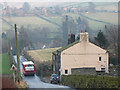
Bus to Mankinholes
The two-hourly bus service from Todmorden to Mankinholes descends the steep hill into Lumbutts.
Image: © Stephen Craven
Taken: 30 Dec 2008
0.04 miles
5
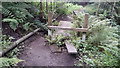
Stile and footbridge on path below Causeway Wood Road, Lumbutts
Image: © Phil Champion
Taken: 18 Aug 2018
0.09 miles
6
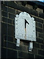
Sundial, Lumbutts
a sundial dating from 1864 - the location is given quite precisely & correctly
Image: © Nigel Homer
Taken: 2 Dec 2006
0.13 miles
7
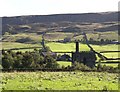
Lumbutts Tower and Lee Farm
This photo was taken looking south from the packhorse track between Lumbutts and Mankinholes. Langfield Edge is in the background, with many bumps and hollows suggesting quarrying in the past.
Image: © Humphrey Bolton
Taken: 15 Sep 2004
0.13 miles
8
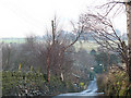
Lumbutts Road
Lumbutts Road descends into the village of that name.
Image: © Stephen Craven
Taken: 30 Dec 2008
0.14 miles
9
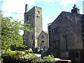
The Lumbutts Centre
Residential conference centre built on the site of Lumbutts Mill. The tower is over 90 feet in height and dominates the village. It housed a unique sequence of three overshot water wheels, fitted one above the other, which drove the machinery.
Image: © Phil Champion
Taken: 14 Aug 2005
0.14 miles
10
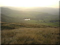
Lumbutts from Langfield Common
Photo taken from the Pennine Way on Langfield Common.
Image: © Phil Champion
Taken: 3 Sep 2005
0.14 miles