
IMAGES TAKEN NEAR TO
Ramsden Road, ROCHDALE, OL12 9NJ
Introduction
This page details the photographs taken nearby to Ramsden Road, OL12 9NJ by members of the Geograph project.
The Geograph project started in 2005 with the aim of publishing, organising and preserving representative images for every square kilometre of Great Britain, Ireland and the Isle of Man.

There are currently over 7.5m images from over14,400 individuals and you can help contribute to the project by visiting https://www.geograph.org.uk
Image Map
Images are licensed for reuse under creativecommons.org/licenses/by-sa/2.0
Notes
- Clicking on the map will re-center to the selected point.
- The higher the marker number, the further away the image location is from the centre of the postcode.
Image Listing (45 Images Found)
Images are licensed for reuse under creativecommons.org/licenses/by-sa/2.0
Image
Details
Distance
1

Ramsden Road, Wardle
Approaching Wardle Village from Watergrove.
Image: © David Dixon
Taken: 1 Mar 2011
0.02 miles
2
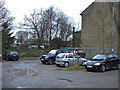
Rear of Wardle Village Church
The church's rear gable is right of shot. The open ground is now used for informal car parking. A resident of 60 years told me that a tannery used to be behind the church/ Methodist chapel.
Image: © michael ely
Taken: 8 Feb 2008
0.05 miles

4
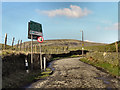
Welcome To Watergrove
At the northern end of Wardle village, the tarmaced surface of Ramsden Road gives way to the old cobbled surface, passing the sign welcoming us to "Watergrove, gateway to the south Pennine Moors". A look at the 1940s OS map (http://wtp2.appspot.com/wheresthepath.htm?lat=53.65150356864973&lon=-2.1339977780424703&gz=14&oz=8>=6 ) shows that this used to lead to, and through, the village of Water Grove (note spelling as two words), "drowned" in the 1930s to make way for the Watergrove (note spelling as one word) Reservoir.
Image: © David Dixon
Taken: 1 Mar 2011
0.07 miles
5
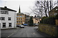
Ramsden Road, Wardle
This is just reaching the central square of the village.
Image: © Bill Boaden
Taken: 31 Dec 2010
0.08 miles
6
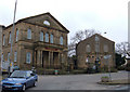
Wardle Village Church
The church is the building on the left. On the right is the local Scout HQ.
Both are situated in the village square that now serves as the bus terminus. The church holds Anglican and Methodist services on alternate Sundays. It was formerly the village's Methodist chapel.
Image: © michael ely
Taken: 8 Feb 2008
0.08 miles
7
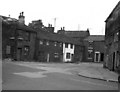
Wardle, Lancashire
This shows the centre of this village as it appeared in 1966. On the extreme right are seen some traditional three-storey weavers' cottages, while Ramsden Road, to the left, once led over the hills to Todmorden, until the way was blocked by Watergrove Reservoir.
Image: © Dr Neil Clifton
Taken: 18 Aug 1966
0.09 miles
8
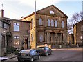
Wardle Village Church
Formerly the village's Methodist chapel, the church now holds Anglican and Methodist services on alternate Sundays as the churches work together in partnership.
Image: © David Dixon
Taken: 11 Feb 2010
0.09 miles
9
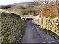
Lower House Lane, Wardle
Leaving Wardle, to the north-west of the village. Brown Wardle Hill Image is in the background
Image: © David Dixon
Taken: 1 Mar 2011
0.09 miles
10
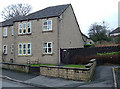
Wardle Fold
An example of warm and comfortable sheltered housing provided by the Anchor Housing Association. These are homes for elderly locals who had once lived elsewhere in the village. Wardle Fold is close to the village square. To see how it looked 42 years ago see Image
Image: © michael ely
Taken: 8 Feb 2008
0.09 miles